You are here: Home > Network List > IU - Global Seismograph Network (GSN - IRIS/USGS) Stations List
> Station RSSD Black Hills, South Dakota, USA > Earthquake Result Viewer
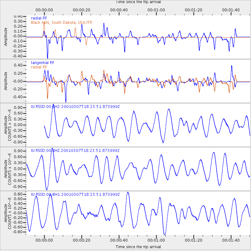
RSSD Black Hills, South Dakota, USA - Earthquake Result Viewer
*The percent match for this event was below the threshold and hence no stack was calculated.
| Earthquake location: |
Ascension Island Region |
| Earthquake latitude/longitude: |
-6.8/-12.9 |
| Earthquake time(UTC): |
2001/03/07 (066) 18:10:58 GMT |
| Earthquake Depth: |
10 km |
| Earthquake Magnitude: |
5.3 MB, 5.6 MS, 6.0 MW, 6.0 MW |
| Earthquake Catalog/Contributor: |
WHDF/NEIC |
|
| Network: |
IU Global Seismograph Network (GSN - IRIS/USGS) |
| Station: |
RSSD Black Hills, South Dakota, USA |
| Lat/Lon: |
44.12 N/104.04 W |
| Elevation: |
2060 m |
|
| Distance: |
95.5 deg |
| Az: |
313.664 deg |
| Baz: |
94.108 deg |
| Ray Param: |
$rayparam |
*The percent match for this event was below the threshold and hence was not used in the summary stack. |
|
| Radial Match: |
53.454903 % |
| Radial Bump: |
400 |
| Transverse Match: |
58.287243 % |
| Transverse Bump: |
400 |
| SOD ConfigId: |
590571 |
| Insert Time: |
2013-09-24 20:23:58.064 +0000 |
| GWidth: |
2.5 |
| Max Bumps: |
400 |
| Tol: |
0.001 |
|
Signal To Noise
| Channel | StoN | STA | LTA |
| IU:RSSD:00:BHZ:20010307T18:23:51.873999Z | 3.3791919 | 7.3210657E-7 | 2.1665139E-7 |
| IU:RSSD:00:BH1:20010307T18:23:51.873999Z | 1.6543303 | 5.384906E-7 | 3.255037E-7 |
| IU:RSSD:00:BH2:20010307T18:23:51.873999Z | 0.7289097 | 2.9062699E-7 | 3.9871466E-7 |
| Arrivals |
| Ps | |
| PpPs | |
| PsPs/PpSs | |


