You are here: Home > Network List > IU - Global Seismograph Network (GSN - IRIS/USGS) Stations List
> Station RSSD Black Hills, South Dakota, USA > Earthquake Result Viewer
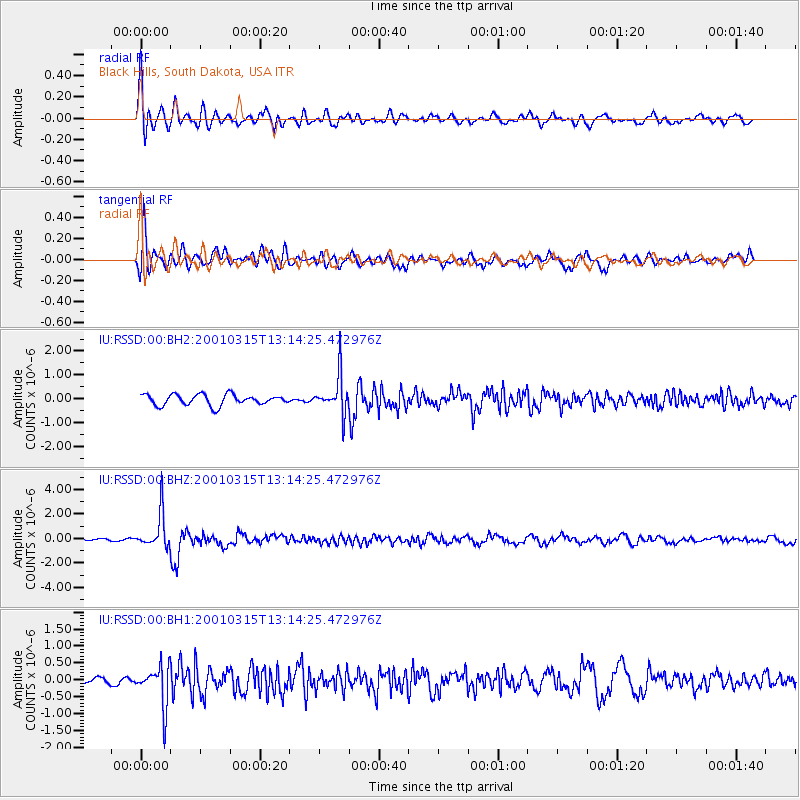
RSSD Black Hills, South Dakota, USA - Earthquake Result Viewer
*The percent match for this event was below the threshold and hence no stack was calculated.
| Earthquake location: |
Near Coast Of Central Chile |
| Earthquake latitude/longitude: |
-32.3/-71.5 |
| Earthquake time(UTC): |
2001/03/15 (074) 13:02:42 GMT |
| Earthquake Depth: |
37 km |
| Earthquake Magnitude: |
6.1 MB, 5.6 MS, 6.0 MW, 5.4 MD |
| Earthquake Catalog/Contributor: |
WHDF/NEIC |
|
| Network: |
IU Global Seismograph Network (GSN - IRIS/USGS) |
| Station: |
RSSD Black Hills, South Dakota, USA |
| Lat/Lon: |
44.12 N/104.04 W |
| Elevation: |
2060 m |
|
| Distance: |
81.7 deg |
| Az: |
336.948 deg |
| Baz: |
152.592 deg |
| Ray Param: |
$rayparam |
*The percent match for this event was below the threshold and hence was not used in the summary stack. |
|
| Radial Match: |
85.97052 % |
| Radial Bump: |
400 |
| Transverse Match: |
71.69787 % |
| Transverse Bump: |
400 |
| SOD ConfigId: |
590571 |
| Insert Time: |
2013-09-24 20:25:29.816 +0000 |
| GWidth: |
2.5 |
| Max Bumps: |
400 |
| Tol: |
0.001 |
|
Signal To Noise
| Channel | StoN | STA | LTA |
| IU:RSSD:00:BHZ:20010315T13:14:25.472976Z | 7.5032763 | 1.4552378E-6 | 1.9394699E-7 |
| IU:RSSD:00:BH1:20010315T13:14:25.472976Z | 3.3847506 | 6.070805E-7 | 1.7935753E-7 |
| IU:RSSD:00:BH2:20010315T13:14:25.472976Z | 3.5627325 | 8.023618E-7 | 2.2520966E-7 |
| Arrivals |
| Ps | |
| PpPs | |
| PsPs/PpSs | |


