You are here: Home > Network List > IU - Global Seismograph Network (GSN - IRIS/USGS) Stations List
> Station RSSD Black Hills, South Dakota, USA > Earthquake Result Viewer
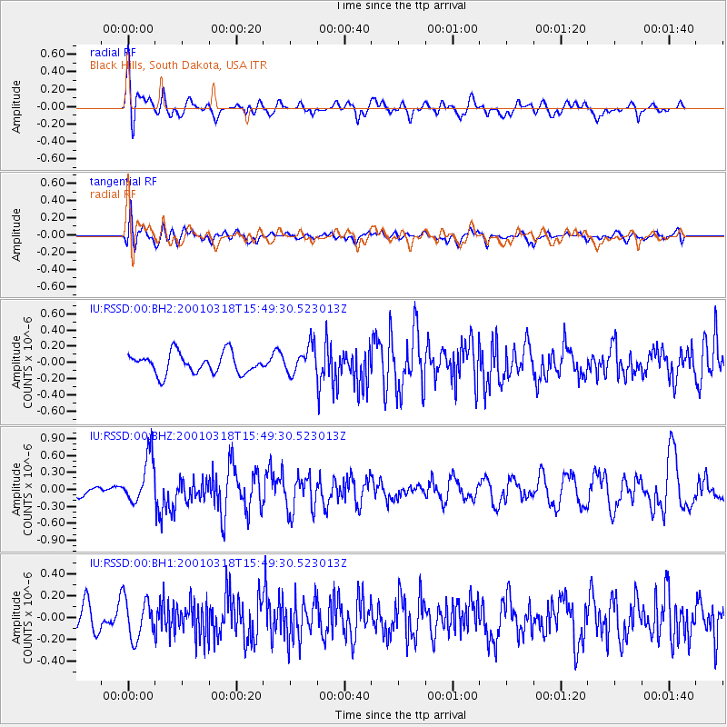
RSSD Black Hills, South Dakota, USA - Earthquake Result Viewer
*The percent match for this event was below the threshold and hence no stack was calculated.
| Earthquake location: |
Near Coast Of Nicaragua |
| Earthquake latitude/longitude: |
12.5/-87.4 |
| Earthquake time(UTC): |
2001/03/18 (077) 15:43:21 GMT |
| Earthquake Depth: |
96 km |
| Earthquake Magnitude: |
5.7 MW, 5.7 MW |
| Earthquake Catalog/Contributor: |
NEIC PDE/NEIC PDE-M |
|
| Network: |
IU Global Seismograph Network (GSN - IRIS/USGS) |
| Station: |
RSSD Black Hills, South Dakota, USA |
| Lat/Lon: |
44.12 N/104.04 W |
| Elevation: |
2060 m |
|
| Distance: |
34.6 deg |
| Az: |
338.688 deg |
| Baz: |
150.478 deg |
| Ray Param: |
$rayparam |
*The percent match for this event was below the threshold and hence was not used in the summary stack. |
|
| Radial Match: |
68.10305 % |
| Radial Bump: |
400 |
| Transverse Match: |
50.671295 % |
| Transverse Bump: |
400 |
| SOD ConfigId: |
590571 |
| Insert Time: |
2013-09-24 20:26:32.463 +0000 |
| GWidth: |
2.5 |
| Max Bumps: |
400 |
| Tol: |
0.001 |
|
Signal To Noise
| Channel | StoN | STA | LTA |
| IU:RSSD:00:BHZ:20010318T15:49:30.523013Z | 2.7767453 | 4.2119052E-7 | 1.5168496E-7 |
| IU:RSSD:00:BH1:20010318T15:49:30.523013Z | 1.4614131 | 1.7992578E-7 | 1.2311766E-7 |
| IU:RSSD:00:BH2:20010318T15:49:30.523013Z | 1.3992542 | 1.7548462E-7 | 1.2541295E-7 |
| Arrivals |
| Ps | |
| PpPs | |
| PsPs/PpSs | |


