You are here: Home > Network List > IU - Global Seismograph Network (GSN - IRIS/USGS) Stations List
> Station POHA Pohakuloa, Hawaii, USA > Earthquake Result Viewer
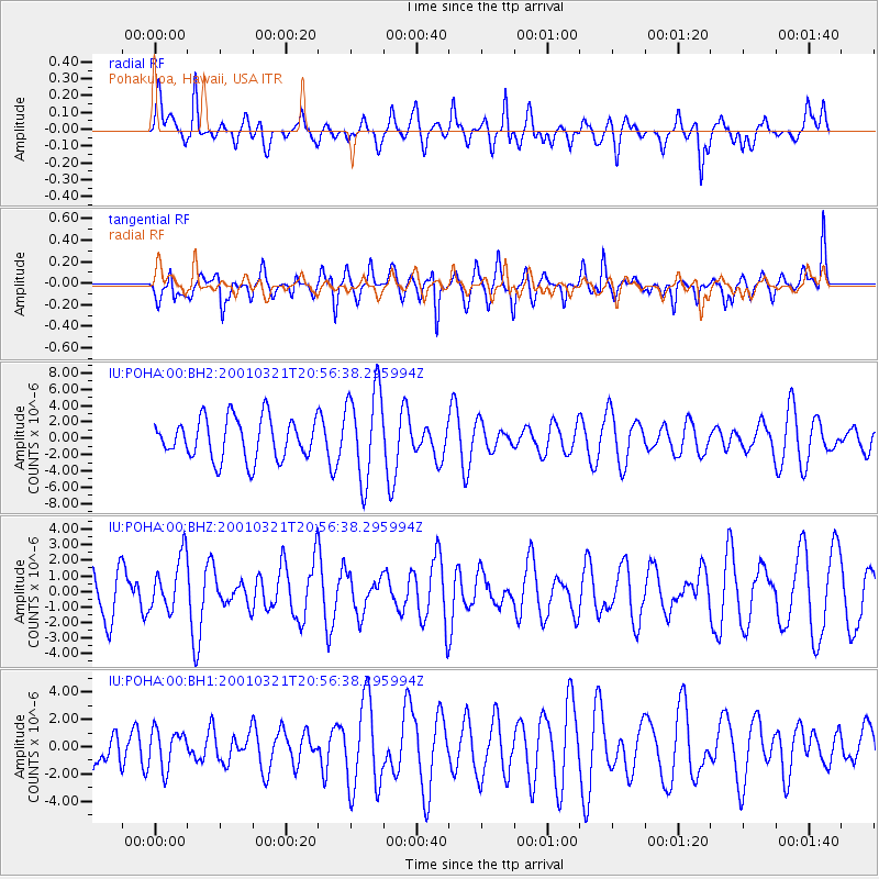
POHA Pohakuloa, Hawaii, USA - Earthquake Result Viewer
*The percent match for this event was below the threshold and hence no stack was calculated.
| Earthquake location: |
New Ireland Region, P.N.G. |
| Earthquake latitude/longitude: |
-4.5/153.1 |
| Earthquake time(UTC): |
2001/03/21 (080) 20:47:34 GMT |
| Earthquake Depth: |
33 km |
| Earthquake Magnitude: |
5.4 MB, 5.5 MS, 5.9 MW, 5.8 MW |
| Earthquake Catalog/Contributor: |
WHDF/NEIC |
|
| Network: |
IU Global Seismograph Network (GSN - IRIS/USGS) |
| Station: |
POHA Pohakuloa, Hawaii, USA |
| Lat/Lon: |
19.76 N/155.53 W |
| Elevation: |
1967 m |
|
| Distance: |
55.9 deg |
| Az: |
62.611 deg |
| Baz: |
250.022 deg |
| Ray Param: |
$rayparam |
*The percent match for this event was below the threshold and hence was not used in the summary stack. |
|
| Radial Match: |
50.23477 % |
| Radial Bump: |
400 |
| Transverse Match: |
60.007008 % |
| Transverse Bump: |
400 |
| SOD ConfigId: |
590571 |
| Insert Time: |
2013-09-24 20:27:16.688 +0000 |
| GWidth: |
2.5 |
| Max Bumps: |
400 |
| Tol: |
0.001 |
|
Signal To Noise
| Channel | StoN | STA | LTA |
| IU:POHA:00:BHZ:20010321T20:56:38.295994Z | 0.8556358 | 1.7473225E-6 | 2.0421332E-6 |
| IU:POHA:00:BH1:20010321T20:56:38.295994Z | 0.670011 | 1.3828313E-6 | 2.0638934E-6 |
| IU:POHA:00:BH2:20010321T20:56:38.295994Z | 2.2322292 | 5.5804135E-6 | 2.4999283E-6 |
| Arrivals |
| Ps | |
| PpPs | |
| PsPs/PpSs | |


