You are here: Home > Network List > IU - Global Seismograph Network (GSN - IRIS/USGS) Stations List
> Station TEIG Tepich, Yucatan, Mexico > Earthquake Result Viewer
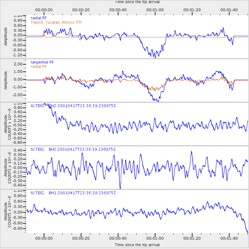
TEIG Tepich, Yucatan, Mexico - Earthquake Result Viewer
*The percent match for this event was below the threshold and hence no stack was calculated.
| Earthquake location: |
Andreanof Islands, Aleutian Is. |
| Earthquake latitude/longitude: |
51.3/-179.8 |
| Earthquake time(UTC): |
2001/04/17 (107) 23:25:29 GMT |
| Earthquake Depth: |
33 km |
| Earthquake Magnitude: |
5.6 ML |
| Earthquake Catalog/Contributor: |
NEIC PDE/NEIC PDE-M |
|
| Network: |
IU Global Seismograph Network (GSN - IRIS/USGS) |
| Station: |
TEIG Tepich, Yucatan, Mexico |
| Lat/Lon: |
20.23 N/88.28 W |
| Elevation: |
69 m |
|
| Distance: |
75.4 deg |
| Az: |
75.911 deg |
| Baz: |
319.562 deg |
| Ray Param: |
$rayparam |
*The percent match for this event was below the threshold and hence was not used in the summary stack. |
|
| Radial Match: |
27.986164 % |
| Radial Bump: |
400 |
| Transverse Match: |
25.10957 % |
| Transverse Bump: |
400 |
| SOD ConfigId: |
590571 |
| Insert Time: |
2013-09-24 20:34:43.983 +0000 |
| GWidth: |
2.5 |
| Max Bumps: |
400 |
| Tol: |
0.001 |
|
Signal To Noise
| Channel | StoN | STA | LTA |
| IU:TEIG: :BHZ:20010417T23:36:39.236975Z | 1.2140945 | 1.1481044E-7 | 9.456467E-8 |
| IU:TEIG: :BH1:20010417T23:36:39.236975Z | 0.86529034 | 5.101289E-7 | 5.895466E-7 |
| IU:TEIG: :BH2:20010417T23:36:39.236975Z | 0.9851384 | 3.5226242E-7 | 3.5757657E-7 |
| Arrivals |
| Ps | |
| PpPs | |
| PsPs/PpSs | |


