You are here: Home > Network List > IU - Global Seismograph Network (GSN - IRIS/USGS) Stations List
> Station RSSD Black Hills, South Dakota, USA > Earthquake Result Viewer
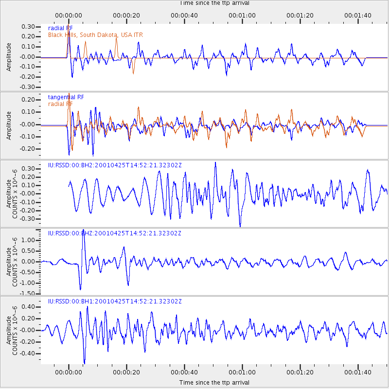
RSSD Black Hills, South Dakota, USA - Earthquake Result Viewer
*The percent match for this event was below the threshold and hence no stack was calculated.
| Earthquake location: |
Shikoku, Japan |
| Earthquake latitude/longitude: |
32.8/132.0 |
| Earthquake time(UTC): |
2001/04/25 (115) 14:40:06 GMT |
| Earthquake Depth: |
33 km |
| Earthquake Magnitude: |
5.7 MW, 5.7 MW, 5.7 MB |
| Earthquake Catalog/Contributor: |
NEIC PDE/NEIC PDE-M |
|
| Network: |
IU Global Seismograph Network (GSN - IRIS/USGS) |
| Station: |
RSSD Black Hills, South Dakota, USA |
| Lat/Lon: |
44.12 N/104.04 W |
| Elevation: |
2060 m |
|
| Distance: |
88.0 deg |
| Az: |
36.718 deg |
| Baz: |
315.655 deg |
| Ray Param: |
$rayparam |
*The percent match for this event was below the threshold and hence was not used in the summary stack. |
|
| Radial Match: |
66.89112 % |
| Radial Bump: |
380 |
| Transverse Match: |
57.952858 % |
| Transverse Bump: |
400 |
| SOD ConfigId: |
590571 |
| Insert Time: |
2013-09-24 20:38:06.781 +0000 |
| GWidth: |
2.5 |
| Max Bumps: |
400 |
| Tol: |
0.001 |
|
Signal To Noise
| Channel | StoN | STA | LTA |
| IU:RSSD:00:BHZ:20010425T14:52:21.32302Z | 4.1740494 | 4.6172593E-7 | 1.1061823E-7 |
| IU:RSSD:00:BH1:20010425T14:52:21.32302Z | 2.5721533 | 1.3587042E-7 | 5.282361E-8 |
| IU:RSSD:00:BH2:20010425T14:52:21.32302Z | 1.7085023 | 1.7549972E-7 | 1.0272139E-7 |
| Arrivals |
| Ps | |
| PpPs | |
| PsPs/PpSs | |


