You are here: Home > Network List > IU - Global Seismograph Network (GSN - IRIS/USGS) Stations List
> Station RSSD Black Hills, South Dakota, USA > Earthquake Result Viewer
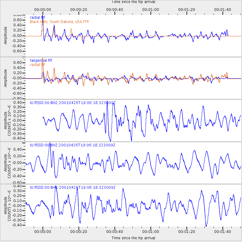
RSSD Black Hills, South Dakota, USA - Earthquake Result Viewer
*The percent match for this event was below the threshold and hence no stack was calculated.
| Earthquake location: |
Northern East Pacific Rise |
| Earthquake latitude/longitude: |
8.3/-103.2 |
| Earthquake time(UTC): |
2001/04/26 (116) 18:59:51 GMT |
| Earthquake Depth: |
10 km |
| Earthquake Magnitude: |
5.7 MW |
| Earthquake Catalog/Contributor: |
NEIC PDE/NEIC PDE-M |
|
| Network: |
IU Global Seismograph Network (GSN - IRIS/USGS) |
| Station: |
RSSD Black Hills, South Dakota, USA |
| Lat/Lon: |
44.12 N/104.04 W |
| Elevation: |
2060 m |
|
| Distance: |
35.7 deg |
| Az: |
358.979 deg |
| Baz: |
178.597 deg |
| Ray Param: |
$rayparam |
*The percent match for this event was below the threshold and hence was not used in the summary stack. |
|
| Radial Match: |
74.939514 % |
| Radial Bump: |
400 |
| Transverse Match: |
61.393005 % |
| Transverse Bump: |
326 |
| SOD ConfigId: |
590571 |
| Insert Time: |
2013-09-24 20:39:00.197 +0000 |
| GWidth: |
2.5 |
| Max Bumps: |
400 |
| Tol: |
0.001 |
|
Signal To Noise
| Channel | StoN | STA | LTA |
| IU:RSSD:00:BHZ:20010426T19:06:18.323009Z | 2.324354 | 2.782114E-7 | 1.1969406E-7 |
| IU:RSSD:00:BH1:20010426T19:06:18.323009Z | 1.1102388 | 1.0552599E-7 | 9.504801E-8 |
| IU:RSSD:00:BH2:20010426T19:06:18.323009Z | 0.63075954 | 7.7000834E-8 | 1.2207636E-7 |
| Arrivals |
| Ps | |
| PpPs | |
| PsPs/PpSs | |


