You are here: Home > Network List > IU - Global Seismograph Network (GSN - IRIS/USGS) Stations List
> Station XMAS Kiritimati Island, Republic of Kiribati > Earthquake Result Viewer
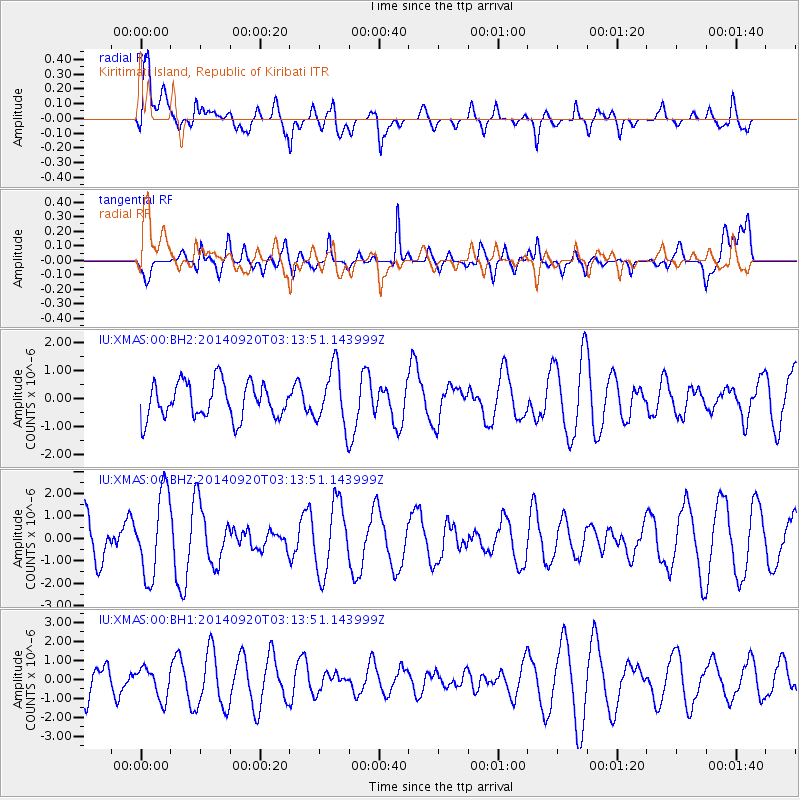
XMAS Kiritimati Island, Republic of Kiribati - Earthquake Result Viewer
*The percent match for this event was below the threshold and hence no stack was calculated.
| Earthquake location: |
Near Coast Of Chiapas, Mexico |
| Earthquake latitude/longitude: |
14.7/-93.8 |
| Earthquake time(UTC): |
2014/09/20 (263) 03:03:50 GMT |
| Earthquake Depth: |
22 km |
| Earthquake Magnitude: |
5.4 MW |
| Earthquake Catalog/Contributor: |
ISC/ISC |
|
| Network: |
IU Global Seismograph Network (GSN - IRIS/USGS) |
| Station: |
XMAS Kiritimati Island, Republic of Kiribati |
| Lat/Lon: |
2.04 N/157.45 W |
| Elevation: |
20 m |
|
| Distance: |
64.0 deg |
| Az: |
265.059 deg |
| Baz: |
74.725 deg |
| Ray Param: |
$rayparam |
*The percent match for this event was below the threshold and hence was not used in the summary stack. |
|
| Radial Match: |
55.61388 % |
| Radial Bump: |
400 |
| Transverse Match: |
43.955544 % |
| Transverse Bump: |
400 |
| SOD ConfigId: |
3390531 |
| Insert Time: |
2019-04-14 03:10:07.107 +0000 |
| GWidth: |
2.5 |
| Max Bumps: |
400 |
| Tol: |
0.001 |
|
Signal To Noise
| Channel | StoN | STA | LTA |
| IU:XMAS:00:BHZ:20140920T03:13:51.143999Z | 2.0592399 | 1.8633278E-6 | 9.04862E-7 |
| IU:XMAS:00:BH1:20140920T03:13:51.143999Z | 0.8617191 | 8.128317E-7 | 9.432676E-7 |
| IU:XMAS:00:BH2:20140920T03:13:51.143999Z | 1.6394914 | 1.0348061E-6 | 6.3117506E-7 |
| Arrivals |
| Ps | |
| PpPs | |
| PsPs/PpSs | |


