You are here: Home > Network List > IU - Global Seismograph Network (GSN - IRIS/USGS) Stations List
> Station RSSD Black Hills, South Dakota, USA > Earthquake Result Viewer
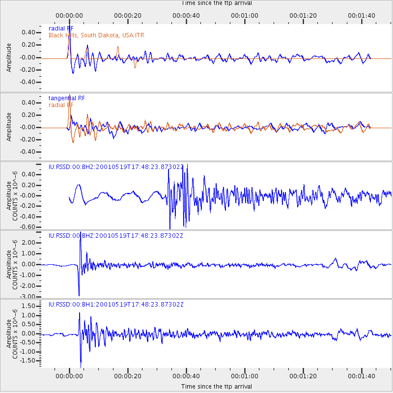
RSSD Black Hills, South Dakota, USA - Earthquake Result Viewer
*The percent match for this event was below the threshold and hence no stack was calculated.
| Earthquake location: |
Fiji Islands Region |
| Earthquake latitude/longitude: |
-19.9/-177.5 |
| Earthquake time(UTC): |
2001/05/19 (139) 17:36:25 GMT |
| Earthquake Depth: |
369 km |
| Earthquake Magnitude: |
5.9 MB, 6.0 MW, 5.9 MW |
| Earthquake Catalog/Contributor: |
WHDF/NEIC |
|
| Network: |
IU Global Seismograph Network (GSN - IRIS/USGS) |
| Station: |
RSSD Black Hills, South Dakota, USA |
| Lat/Lon: |
44.12 N/104.04 W |
| Elevation: |
2060 m |
|
| Distance: |
92.4 deg |
| Az: |
43.716 deg |
| Baz: |
244.548 deg |
| Ray Param: |
$rayparam |
*The percent match for this event was below the threshold and hence was not used in the summary stack. |
|
| Radial Match: |
78.126236 % |
| Radial Bump: |
400 |
| Transverse Match: |
68.68667 % |
| Transverse Bump: |
400 |
| SOD ConfigId: |
590571 |
| Insert Time: |
2013-09-24 20:44:05.841 +0000 |
| GWidth: |
2.5 |
| Max Bumps: |
400 |
| Tol: |
0.001 |
|
Signal To Noise
| Channel | StoN | STA | LTA |
| IU:RSSD:00:BHZ:20010519T17:48:23.87302Z | 8.8404665 | 9.296433E-7 | 1.05157724E-7 |
| IU:RSSD:00:BH1:20010519T17:48:23.87302Z | 7.7433767 | 4.7203454E-7 | 6.095978E-8 |
| IU:RSSD:00:BH2:20010519T17:48:23.87302Z | 2.1774364 | 1.8245028E-7 | 8.379132E-8 |
| Arrivals |
| Ps | |
| PpPs | |
| PsPs/PpSs | |


