You are here: Home > Network List > IU - Global Seismograph Network (GSN - IRIS/USGS) Stations List
> Station POHA Pohakuloa, Hawaii, USA > Earthquake Result Viewer
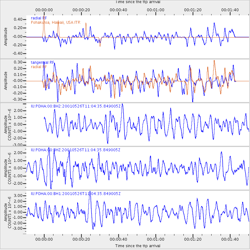
POHA Pohakuloa, Hawaii, USA - Earthquake Result Viewer
*The percent match for this event was below the threshold and hence no stack was calculated.
| Earthquake location: |
Fiji Islands Region |
| Earthquake latitude/longitude: |
-20.3/-177.8 |
| Earthquake time(UTC): |
2001/05/26 (146) 10:57:26 GMT |
| Earthquake Depth: |
406 km |
| Earthquake Magnitude: |
5.3 MB, 6.4 MW, 6.4 MW |
| Earthquake Catalog/Contributor: |
WHDF/NEIC |
|
| Network: |
IU Global Seismograph Network (GSN - IRIS/USGS) |
| Station: |
POHA Pohakuloa, Hawaii, USA |
| Lat/Lon: |
19.76 N/155.53 W |
| Elevation: |
1967 m |
|
| Distance: |
45.4 deg |
| Az: |
30.138 deg |
| Baz: |
210.027 deg |
| Ray Param: |
$rayparam |
*The percent match for this event was below the threshold and hence was not used in the summary stack. |
|
| Radial Match: |
46.14733 % |
| Radial Bump: |
400 |
| Transverse Match: |
42.49998 % |
| Transverse Bump: |
354 |
| SOD ConfigId: |
590571 |
| Insert Time: |
2013-09-24 20:45:56.441 +0000 |
| GWidth: |
2.5 |
| Max Bumps: |
400 |
| Tol: |
0.001 |
|
Signal To Noise
| Channel | StoN | STA | LTA |
| IU:POHA:00:BHZ:20010526T11:04:35.849005Z | 2.579226 | 1.7021989E-6 | 6.5996505E-7 |
| IU:POHA:00:BH1:20010526T11:04:35.849005Z | 1.2039645 | 1.1532148E-6 | 9.578479E-7 |
| IU:POHA:00:BH2:20010526T11:04:35.849005Z | 1.2873722 | 1.1040864E-6 | 8.57628E-7 |
| Arrivals |
| Ps | |
| PpPs | |
| PsPs/PpSs | |


