You are here: Home > Network List > IU - Global Seismograph Network (GSN - IRIS/USGS) Stations List
> Station JOHN Johnston Island, USA > Earthquake Result Viewer
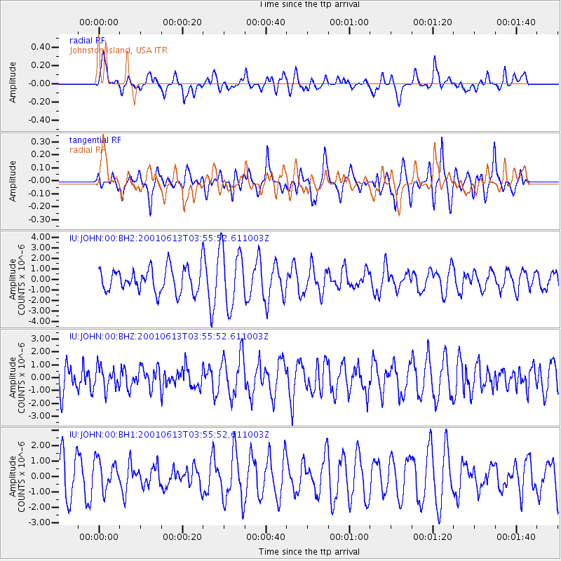
JOHN Johnston Island, USA - Earthquake Result Viewer
*The percent match for this event was below the threshold and hence no stack was calculated.
| Earthquake location: |
Tonga Islands |
| Earthquake latitude/longitude: |
-18.8/-173.4 |
| Earthquake time(UTC): |
2001/06/13 (164) 03:49:29 GMT |
| Earthquake Depth: |
33 km |
| Earthquake Magnitude: |
5.5 MW |
| Earthquake Catalog/Contributor: |
NEIC PDE/NEIC PDE-M |
|
| Network: |
IU Global Seismograph Network (GSN - IRIS/USGS) |
| Station: |
JOHN Johnston Island, USA |
| Lat/Lon: |
16.73 N/169.53 W |
| Elevation: |
2.0 m |
|
| Distance: |
35.5 deg |
| Az: |
6.315 deg |
| Baz: |
186.241 deg |
| Ray Param: |
$rayparam |
*The percent match for this event was below the threshold and hence was not used in the summary stack. |
|
| Radial Match: |
34.34248 % |
| Radial Bump: |
400 |
| Transverse Match: |
42.88447 % |
| Transverse Bump: |
377 |
| SOD ConfigId: |
590571 |
| Insert Time: |
2013-09-24 20:50:35.019 +0000 |
| GWidth: |
2.5 |
| Max Bumps: |
400 |
| Tol: |
0.001 |
|
Signal To Noise
| Channel | StoN | STA | LTA |
| IU:JOHN:00:BHZ:20010613T03:55:52.611003Z | 0.76944417 | 8.587939E-7 | 1.1161225E-6 |
| IU:JOHN:00:BH1:20010613T03:55:52.611003Z | 0.7364711 | 9.544133E-7 | 1.2959276E-6 |
| IU:JOHN:00:BH2:20010613T03:55:52.611003Z | 2.4297793 | 2.774212E-6 | 1.1417546E-6 |
| Arrivals |
| Ps | |
| PpPs | |
| PsPs/PpSs | |


