You are here: Home > Network List > IU - Global Seismograph Network (GSN - IRIS/USGS) Stations List
> Station RSSD Black Hills, South Dakota, USA > Earthquake Result Viewer
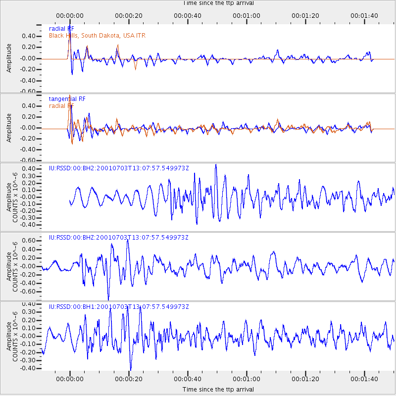
RSSD Black Hills, South Dakota, USA - Earthquake Result Viewer
*The percent match for this event was below the threshold and hence no stack was calculated.
| Earthquake location: |
Near Coast Of Peru |
| Earthquake latitude/longitude: |
-16.6/-74.0 |
| Earthquake time(UTC): |
2001/07/03 (184) 12:57:42 GMT |
| Earthquake Depth: |
33 km |
| Earthquake Magnitude: |
5.4 MB, 5.1 MS, 5.8 MW, 5.6 MW |
| Earthquake Catalog/Contributor: |
WHDF/NEIC |
|
| Network: |
IU Global Seismograph Network (GSN - IRIS/USGS) |
| Station: |
RSSD Black Hills, South Dakota, USA |
| Lat/Lon: |
44.12 N/104.04 W |
| Elevation: |
2060 m |
|
| Distance: |
66.4 deg |
| Az: |
336.812 deg |
| Baz: |
148.389 deg |
| Ray Param: |
$rayparam |
*The percent match for this event was below the threshold and hence was not used in the summary stack. |
|
| Radial Match: |
68.43632 % |
| Radial Bump: |
344 |
| Transverse Match: |
72.13535 % |
| Transverse Bump: |
400 |
| SOD ConfigId: |
590571 |
| Insert Time: |
2013-09-24 21:02:05.935 +0000 |
| GWidth: |
2.5 |
| Max Bumps: |
400 |
| Tol: |
0.001 |
|
Signal To Noise
| Channel | StoN | STA | LTA |
| IU:RSSD:00:BHZ:20010703T13:07:57.549973Z | 1.5489227 | 1.6503814E-7 | 1.0655028E-7 |
| IU:RSSD:00:BH1:20010703T13:07:57.549973Z | 1.1303262 | 1.0998235E-7 | 9.730143E-8 |
| IU:RSSD:00:BH2:20010703T13:07:57.549973Z | 2.0744321 | 1.680463E-7 | 8.100834E-8 |
| Arrivals |
| Ps | |
| PpPs | |
| PsPs/PpSs | |


