You are here: Home > Network List > IU - Global Seismograph Network (GSN - IRIS/USGS) Stations List
> Station RSSD Black Hills, South Dakota, USA > Earthquake Result Viewer
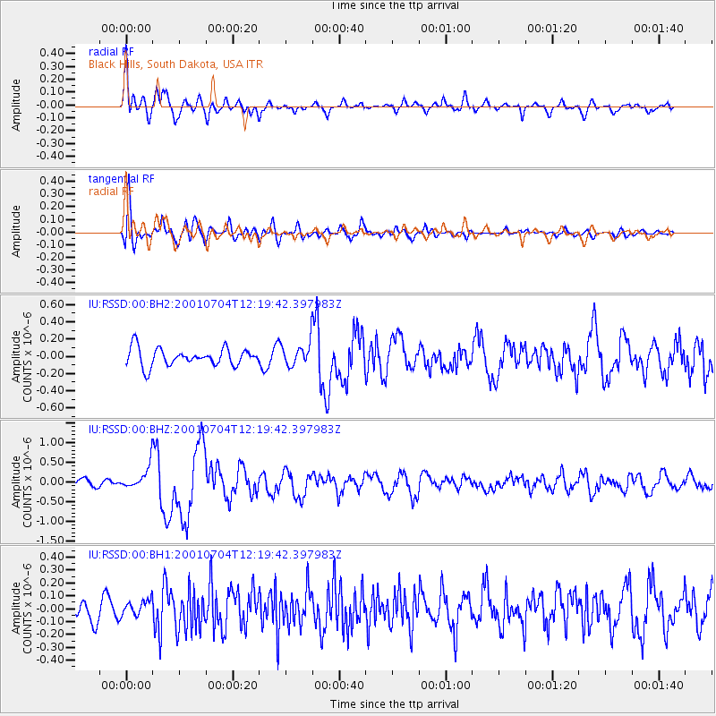
RSSD Black Hills, South Dakota, USA - Earthquake Result Viewer
*The percent match for this event was below the threshold and hence no stack was calculated.
| Earthquake location: |
Central Bolivia |
| Earthquake latitude/longitude: |
-17.0/-65.7 |
| Earthquake time(UTC): |
2001/07/04 (185) 12:09:03 GMT |
| Earthquake Depth: |
33 km |
| Earthquake Magnitude: |
5.6 MB, 5.9 MS, 6.1 MW, 6.1 MW |
| Earthquake Catalog/Contributor: |
WHDF/NEIC |
|
| Network: |
IU Global Seismograph Network (GSN - IRIS/USGS) |
| Station: |
RSSD Black Hills, South Dakota, USA |
| Lat/Lon: |
44.12 N/104.04 W |
| Elevation: |
2060 m |
|
| Distance: |
70.2 deg |
| Az: |
331.658 deg |
| Baz: |
140.898 deg |
| Ray Param: |
$rayparam |
*The percent match for this event was below the threshold and hence was not used in the summary stack. |
|
| Radial Match: |
68.91689 % |
| Radial Bump: |
400 |
| Transverse Match: |
73.853516 % |
| Transverse Bump: |
400 |
| SOD ConfigId: |
590571 |
| Insert Time: |
2013-09-24 21:03:52.211 +0000 |
| GWidth: |
2.5 |
| Max Bumps: |
400 |
| Tol: |
0.001 |
|
Signal To Noise
| Channel | StoN | STA | LTA |
| IU:RSSD:00:BHZ:20010704T12:19:42.397983Z | 2.7829957 | 2.966299E-7 | 1.06586555E-7 |
| IU:RSSD:00:BH1:20010704T12:19:42.397983Z | 0.59561765 | 6.10078E-8 | 1.024278E-7 |
| IU:RSSD:00:BH2:20010704T12:19:42.397983Z | 1.218605 | 1.2398253E-7 | 1.01741364E-7 |
| Arrivals |
| Ps | |
| PpPs | |
| PsPs/PpSs | |


