You are here: Home > Network List > IU - Global Seismograph Network (GSN - IRIS/USGS) Stations List
> Station RSSD Black Hills, South Dakota, USA > Earthquake Result Viewer
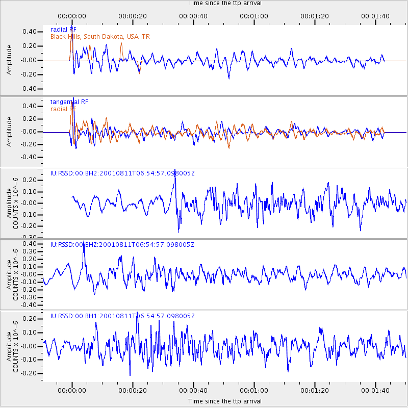
RSSD Black Hills, South Dakota, USA - Earthquake Result Viewer
*The percent match for this event was below the threshold and hence no stack was calculated.
| Earthquake location: |
Near Coast Of Peru |
| Earthquake latitude/longitude: |
-17.9/-71.2 |
| Earthquake time(UTC): |
2001/08/11 (223) 06:44:28 GMT |
| Earthquake Depth: |
37 km |
| Earthquake Magnitude: |
5.6 MB |
| Earthquake Catalog/Contributor: |
NEIC PDE/NEIC PDE-M |
|
| Network: |
IU Global Seismograph Network (GSN - IRIS/USGS) |
| Station: |
RSSD Black Hills, South Dakota, USA |
| Lat/Lon: |
44.12 N/104.04 W |
| Elevation: |
2060 m |
|
| Distance: |
68.6 deg |
| Az: |
335.212 deg |
| Baz: |
146.336 deg |
| Ray Param: |
$rayparam |
*The percent match for this event was below the threshold and hence was not used in the summary stack. |
|
| Radial Match: |
62.45305 % |
| Radial Bump: |
400 |
| Transverse Match: |
64.59682 % |
| Transverse Bump: |
400 |
| SOD ConfigId: |
590571 |
| Insert Time: |
2013-09-24 21:16:45.262 +0000 |
| GWidth: |
2.5 |
| Max Bumps: |
400 |
| Tol: |
0.001 |
|
Signal To Noise
| Channel | StoN | STA | LTA |
| IU:RSSD:00:BHZ:20010811T06:54:57.098005Z | 2.6961777 | 1.5890657E-7 | 5.8937722E-8 |
| IU:RSSD:00:BH1:20010811T06:54:57.098005Z | 1.0189648 | 3.6653873E-8 | 3.597168E-8 |
| IU:RSSD:00:BH2:20010811T06:54:57.098005Z | 2.1611304 | 1.03575665E-7 | 4.792662E-8 |
| Arrivals |
| Ps | |
| PpPs | |
| PsPs/PpSs | |


