You are here: Home > Network List > IU - Global Seismograph Network (GSN - IRIS/USGS) Stations List
> Station RSSD Black Hills, South Dakota, USA > Earthquake Result Viewer
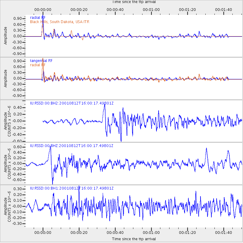
RSSD Black Hills, South Dakota, USA - Earthquake Result Viewer
*The percent match for this event was below the threshold and hence no stack was calculated.
| Earthquake location: |
Near Coast Of Nicaragua |
| Earthquake latitude/longitude: |
11.5/-86.7 |
| Earthquake time(UTC): |
2001/08/12 (224) 15:53:51 GMT |
| Earthquake Depth: |
30 km |
| Earthquake Magnitude: |
5.6 MW |
| Earthquake Catalog/Contributor: |
NEIC PDE/NEIC PDE-M |
|
| Network: |
IU Global Seismograph Network (GSN - IRIS/USGS) |
| Station: |
RSSD Black Hills, South Dakota, USA |
| Lat/Lon: |
44.12 N/104.04 W |
| Elevation: |
2060 m |
|
| Distance: |
35.8 deg |
| Az: |
338.479 deg |
| Baz: |
150.049 deg |
| Ray Param: |
$rayparam |
*The percent match for this event was below the threshold and hence was not used in the summary stack. |
|
| Radial Match: |
79.20866 % |
| Radial Bump: |
400 |
| Transverse Match: |
56.22072 % |
| Transverse Bump: |
400 |
| SOD ConfigId: |
590571 |
| Insert Time: |
2013-09-24 21:17:25.012 +0000 |
| GWidth: |
2.5 |
| Max Bumps: |
400 |
| Tol: |
0.001 |
|
Signal To Noise
| Channel | StoN | STA | LTA |
| IU:RSSD:00:BHZ:20010812T16:00:17.49801Z | 6.141915 | 2.5596225E-7 | 4.1674667E-8 |
| IU:RSSD:00:BH1:20010812T16:00:17.49801Z | 0.880145 | 4.959461E-8 | 5.6348227E-8 |
| IU:RSSD:00:BH2:20010812T16:00:17.49801Z | 4.5067325 | 1.9038168E-7 | 4.2243837E-8 |
| Arrivals |
| Ps | |
| PpPs | |
| PsPs/PpSs | |


