POHA Pohakuloa, Hawaii, USA - Earthquake Result Viewer
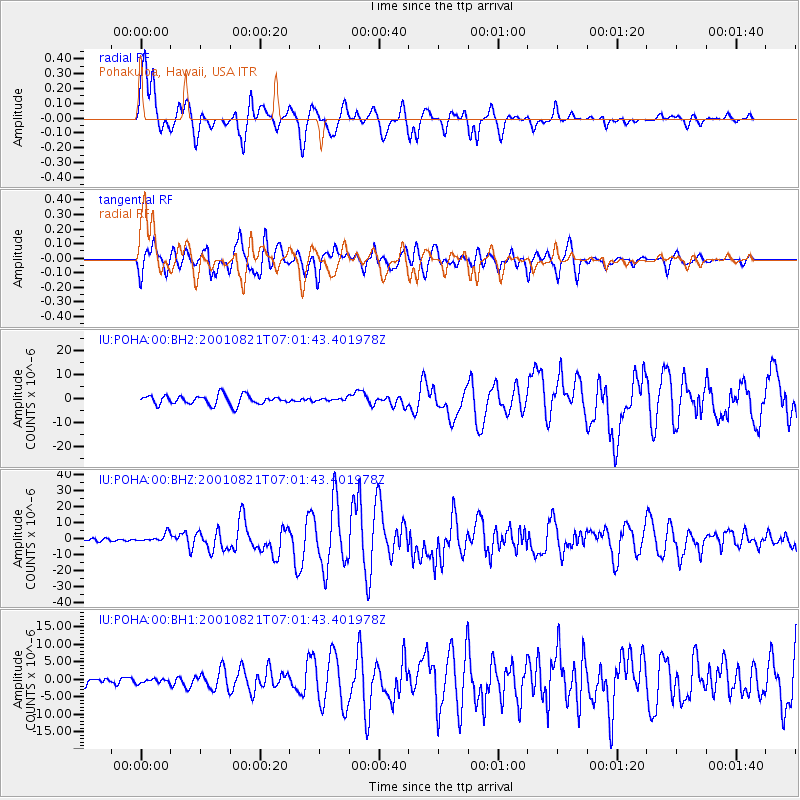
Earthquake location: East Of North Island, N.Z.
Earthquake latitude/longitude: -36.8/-179.6
Earthquake time(UTC): 2001/08/21 (233) 06:52:06 GMT
Earthquake Depth: 33 km
Earthquake Magnitude: 6.4 MB, 7.1 MS, 7.2 ME, 7.0 ML
Earthquake Catalog/Contributor: WHDF/NEIC
Network: IU Global Seismograph Network (GSN - IRIS/USGS)
Station: POHA Pohakuloa, Hawaii, USA
Lat/Lon: 19.76 N/155.53 W
Elevation: 1967 m
Distance: 60.7 deg
Az: 26.112 deg
Baz: 202.026 deg
Ray Param: 0.061320398
Estimated Moho Depth: 15.25 km
Estimated Crust Vp/Vs: 1.64
Assumed Crust Vp: 5.195 km/s
Estimated Crust Vs: 3.158 km/s
Estimated Crust Poisson's Ratio: 0.21
Radial Match: 91.868546 %
Radial Bump: 400
Transverse Match: 85.65158 %
Transverse Bump: 400
SOD ConfigId: 590571
Insert Time: 2013-09-24 21:19:47.306 +0000
GWidth: 2.5
Max Bumps: 400
Tol: 0.001

Signal To Noise

ChannelStoNSTALTA
IU:POHA:00:BHZ:20010821T07:01:43.401978Z2.29900032.708839E-61.1782683E-6
IU:POHA:00:BH1:20010821T07:01:43.401978Z0.420832075.753377E-71.3671432E-6
IU:POHA:00:BH2:20010821T07:01:43.401978Z0.323933966.3765833E-71.9684824E-6
Arrivals
Ps2.0 SECOND
PpPs7.5 SECOND
PsPs/PpSs9.5 SECOND