You are here: Home > Network List > IU - Global Seismograph Network (GSN - IRIS/USGS) Stations List
> Station RSSD Black Hills, South Dakota, USA > Earthquake Result Viewer
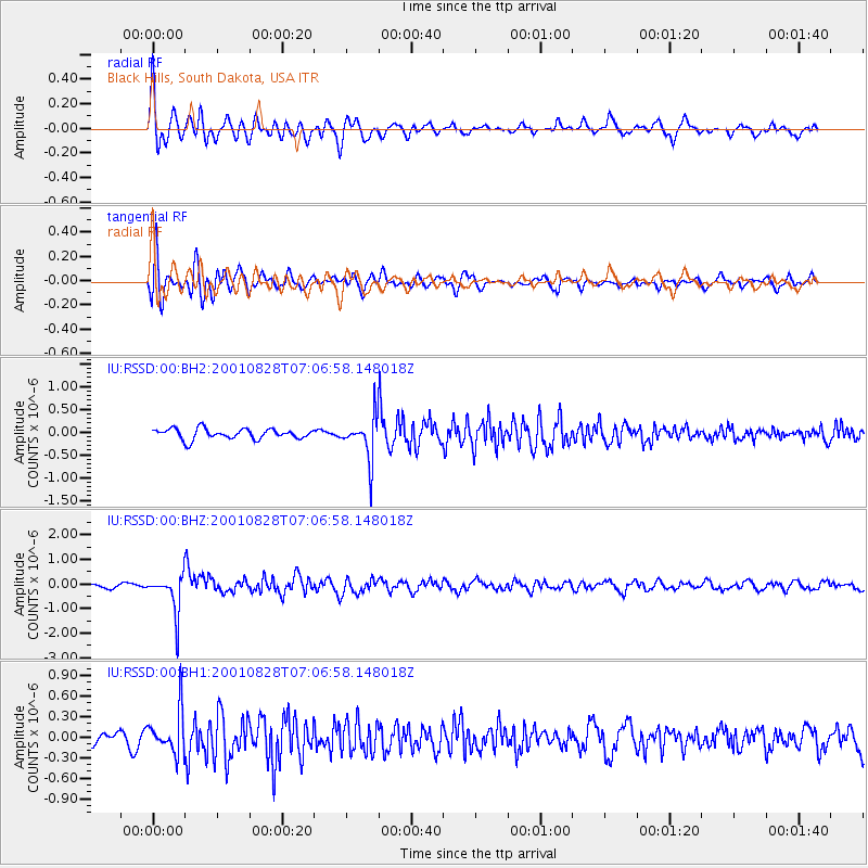
RSSD Black Hills, South Dakota, USA - Earthquake Result Viewer
*The percent match for this event was below the threshold and hence no stack was calculated.
| Earthquake location: |
Near Coast Of Northern Chile |
| Earthquake latitude/longitude: |
-21.7/-70.1 |
| Earthquake time(UTC): |
2001/08/28 (240) 06:56:09 GMT |
| Earthquake Depth: |
66 km |
| Earthquake Magnitude: |
5.8 MB, 5.9 MW, 5.8 MW |
| Earthquake Catalog/Contributor: |
WHDF/NEIC |
|
| Network: |
IU Global Seismograph Network (GSN - IRIS/USGS) |
| Station: |
RSSD Black Hills, South Dakota, USA |
| Lat/Lon: |
44.12 N/104.04 W |
| Elevation: |
2060 m |
|
| Distance: |
72.5 deg |
| Az: |
335.074 deg |
| Baz: |
147.035 deg |
| Ray Param: |
$rayparam |
*The percent match for this event was below the threshold and hence was not used in the summary stack. |
|
| Radial Match: |
74.80397 % |
| Radial Bump: |
400 |
| Transverse Match: |
64.67498 % |
| Transverse Bump: |
400 |
| SOD ConfigId: |
590571 |
| Insert Time: |
2013-09-24 21:21:35.293 +0000 |
| GWidth: |
2.5 |
| Max Bumps: |
400 |
| Tol: |
0.001 |
|
Signal To Noise
| Channel | StoN | STA | LTA |
| IU:RSSD:00:BHZ:20010828T07:06:58.148018Z | 5.94759 | 7.970534E-7 | 1.3401284E-7 |
| IU:RSSD:00:BH1:20010828T07:06:58.148018Z | 3.6700466 | 3.0733258E-7 | 8.374079E-8 |
| IU:RSSD:00:BH2:20010828T07:06:58.148018Z | 4.1075606 | 4.7142535E-7 | 1.14770145E-7 |
| Arrivals |
| Ps | |
| PpPs | |
| PsPs/PpSs | |


