You are here: Home > Network List > IU - Global Seismograph Network (GSN - IRIS/USGS) Stations List
> Station JOHN Johnston Island, USA > Earthquake Result Viewer
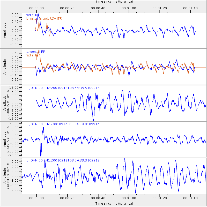
JOHN Johnston Island, USA - Earthquake Result Viewer
*The percent match for this event was below the threshold and hence no stack was calculated.
| Earthquake location: |
Fiji Islands Region |
| Earthquake latitude/longitude: |
-21.0/-179.1 |
| Earthquake time(UTC): |
2001/09/12 (255) 08:48:37 GMT |
| Earthquake Depth: |
608 km |
| Earthquake Magnitude: |
5.7 MB, 6.5 MW, 6.4 MW |
| Earthquake Catalog/Contributor: |
WHDF/NEIC |
|
| Network: |
IU Global Seismograph Network (GSN - IRIS/USGS) |
| Station: |
JOHN Johnston Island, USA |
| Lat/Lon: |
16.73 N/169.53 W |
| Elevation: |
2.0 m |
|
| Distance: |
38.7 deg |
| Az: |
14.792 deg |
| Baz: |
194.417 deg |
| Ray Param: |
$rayparam |
*The percent match for this event was below the threshold and hence was not used in the summary stack. |
|
| Radial Match: |
73.14822 % |
| Radial Bump: |
400 |
| Transverse Match: |
49.438313 % |
| Transverse Bump: |
400 |
| SOD ConfigId: |
590571 |
| Insert Time: |
2013-09-24 21:25:56.757 +0000 |
| GWidth: |
2.5 |
| Max Bumps: |
400 |
| Tol: |
0.001 |
|
Signal To Noise
| Channel | StoN | STA | LTA |
| IU:JOHN:00:BHZ:20010912T08:54:39.910991Z | 2.8378556 | 8.575267E-6 | 3.021742E-6 |
| IU:JOHN:00:BH1:20010912T08:54:39.910991Z | 1.8881879 | 3.2963737E-6 | 1.7457869E-6 |
| IU:JOHN:00:BH2:20010912T08:54:39.910991Z | 2.002922 | 4.858801E-6 | 2.4258563E-6 |
| Arrivals |
| Ps | |
| PpPs | |
| PsPs/PpSs | |


