You are here: Home > Network List > IU - Global Seismograph Network (GSN - IRIS/USGS) Stations List
> Station RSSD Black Hills, South Dakota, USA > Earthquake Result Viewer
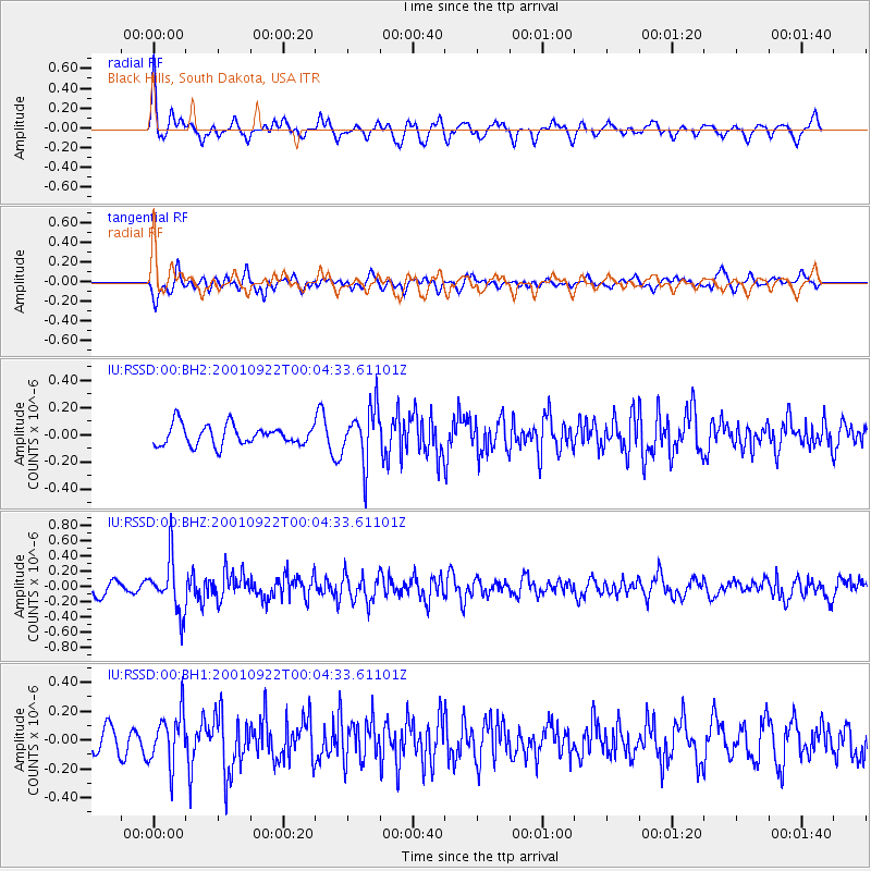
RSSD Black Hills, South Dakota, USA - Earthquake Result Viewer
*The percent match for this event was below the threshold and hence no stack was calculated.
| Earthquake location: |
Andreanof Islands, Aleutian Is. |
| Earthquake latitude/longitude: |
51.8/-175.3 |
| Earthquake time(UTC): |
2001/09/21 (264) 23:56:39 GMT |
| Earthquake Depth: |
33 km |
| Earthquake Magnitude: |
5.5 MW, 5.6 MW |
| Earthquake Catalog/Contributor: |
NEIC PDE/NEIC PDE-M |
|
| Network: |
IU Global Seismograph Network (GSN - IRIS/USGS) |
| Station: |
RSSD Black Hills, South Dakota, USA |
| Lat/Lon: |
44.12 N/104.04 W |
| Elevation: |
2060 m |
|
| Distance: |
46.6 deg |
| Az: |
69.894 deg |
| Baz: |
305.913 deg |
| Ray Param: |
$rayparam |
*The percent match for this event was below the threshold and hence was not used in the summary stack. |
|
| Radial Match: |
70.937416 % |
| Radial Bump: |
398 |
| Transverse Match: |
51.451138 % |
| Transverse Bump: |
400 |
| SOD ConfigId: |
590571 |
| Insert Time: |
2013-09-24 21:30:23.096 +0000 |
| GWidth: |
2.5 |
| Max Bumps: |
400 |
| Tol: |
0.001 |
|
Signal To Noise
| Channel | StoN | STA | LTA |
| IU:RSSD:00:BHZ:20010922T00:04:33.61101Z | 4.223156 | 3.493883E-7 | 8.273157E-8 |
| IU:RSSD:00:BH1:20010922T00:04:33.61101Z | 2.1866884 | 1.7884457E-7 | 8.178786E-8 |
| IU:RSSD:00:BH2:20010922T00:04:33.61101Z | 2.8061292 | 2.052231E-7 | 7.3133876E-8 |
| Arrivals |
| Ps | |
| PpPs | |
| PsPs/PpSs | |


