You are here: Home > Network List > IU - Global Seismograph Network (GSN - IRIS/USGS) Stations List
> Station JOHN Johnston Island, USA > Earthquake Result Viewer
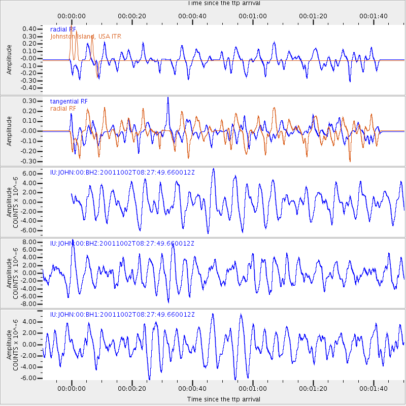
JOHN Johnston Island, USA - Earthquake Result Viewer
*The percent match for this event was below the threshold and hence no stack was calculated.
| Earthquake location: |
Near East Coast Of Honshu, Japan |
| Earthquake latitude/longitude: |
37.7/141.8 |
| Earthquake time(UTC): |
2001/10/02 (275) 08:19:49 GMT |
| Earthquake Depth: |
43 km |
| Earthquake Magnitude: |
5.6 MW |
| Earthquake Catalog/Contributor: |
NEIC PDE/NEIC PDE-M |
|
| Network: |
IU Global Seismograph Network (GSN - IRIS/USGS) |
| Station: |
JOHN Johnston Island, USA |
| Lat/Lon: |
16.73 N/169.53 W |
| Elevation: |
2.0 m |
|
| Distance: |
47.5 deg |
| Az: |
102.428 deg |
| Baz: |
306.099 deg |
| Ray Param: |
$rayparam |
*The percent match for this event was below the threshold and hence was not used in the summary stack. |
|
| Radial Match: |
53.19164 % |
| Radial Bump: |
400 |
| Transverse Match: |
62.546368 % |
| Transverse Bump: |
400 |
| SOD ConfigId: |
590571 |
| Insert Time: |
2013-09-24 21:34:06.087 +0000 |
| GWidth: |
2.5 |
| Max Bumps: |
400 |
| Tol: |
0.001 |
|
Signal To Noise
| Channel | StoN | STA | LTA |
| IU:JOHN:00:BHZ:20011002T08:27:49.660012Z | 2.1013827 | 4.2042534E-6 | 2.000708E-6 |
| IU:JOHN:00:BH1:20011002T08:27:49.660012Z | 0.62927014 | 1.3412646E-6 | 2.1314609E-6 |
| IU:JOHN:00:BH2:20011002T08:27:49.660012Z | 0.9025745 | 2.2630895E-6 | 2.5073714E-6 |
| Arrivals |
| Ps | |
| PpPs | |
| PsPs/PpSs | |


