You are here: Home > Network List > IU - Global Seismograph Network (GSN - IRIS/USGS) Stations List
> Station RSSD Black Hills, South Dakota, USA > Earthquake Result Viewer
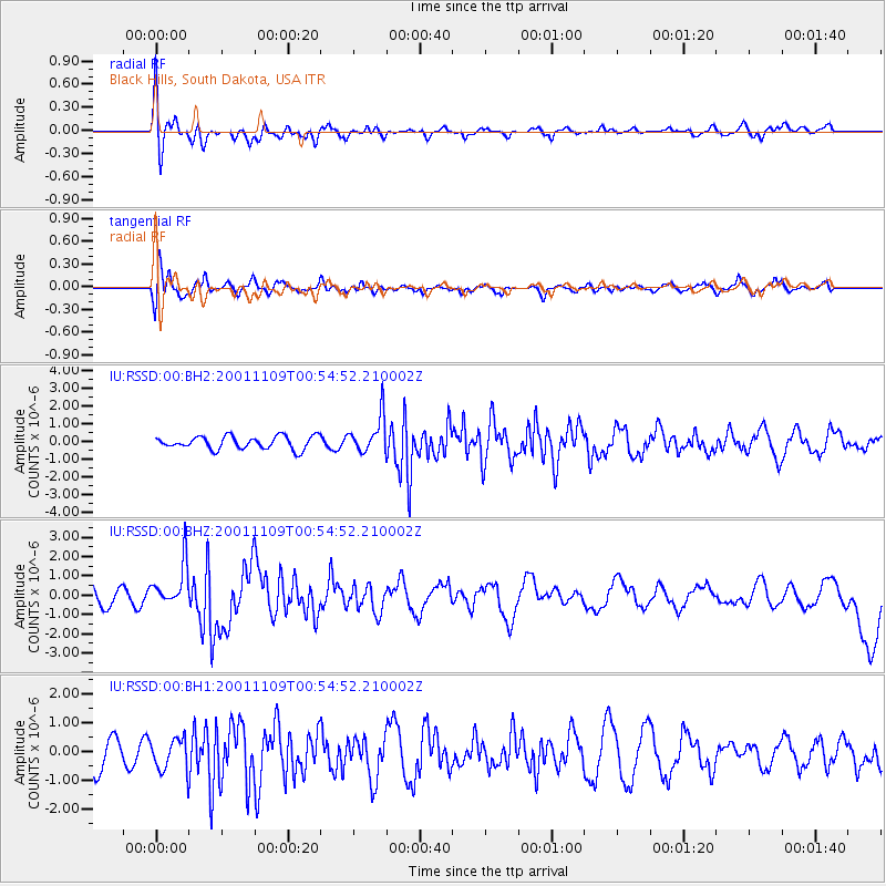
RSSD Black Hills, South Dakota, USA - Earthquake Result Viewer
*The percent match for this event was below the threshold and hence no stack was calculated.
| Earthquake location: |
Panama-Costa Rica Border Region |
| Earthquake latitude/longitude: |
9.6/-82.3 |
| Earthquake time(UTC): |
2001/11/09 (313) 00:47:55 GMT |
| Earthquake Depth: |
10 km |
| Earthquake Magnitude: |
6.1 MB, 5.7 MS, 6.1 MW, 6.1 MW |
| Earthquake Catalog/Contributor: |
WHDF/NEIC |
|
| Network: |
IU Global Seismograph Network (GSN - IRIS/USGS) |
| Station: |
RSSD Black Hills, South Dakota, USA |
| Lat/Lon: |
44.12 N/104.04 W |
| Elevation: |
2060 m |
|
| Distance: |
39.2 deg |
| Az: |
335.029 deg |
| Baz: |
144.692 deg |
| Ray Param: |
$rayparam |
*The percent match for this event was below the threshold and hence was not used in the summary stack. |
|
| Radial Match: |
67.54697 % |
| Radial Bump: |
400 |
| Transverse Match: |
72.591896 % |
| Transverse Bump: |
400 |
| SOD ConfigId: |
590571 |
| Insert Time: |
2013-09-24 21:45:58.848 +0000 |
| GWidth: |
2.5 |
| Max Bumps: |
400 |
| Tol: |
0.001 |
|
Signal To Noise
| Channel | StoN | STA | LTA |
| IU:RSSD:00:BHZ:20011109T00:54:52.210002Z | 1.2001054 | 1.0884912E-6 | 9.069963E-7 |
| IU:RSSD:00:BH1:20011109T00:54:52.210002Z | 0.51602143 | 5.655364E-7 | 1.0959553E-6 |
| IU:RSSD:00:BH2:20011109T00:54:52.210002Z | 2.8690958 | 1.0361814E-6 | 3.6115262E-7 |
| Arrivals |
| Ps | |
| PpPs | |
| PsPs/PpSs | |


