You are here: Home > Network List > IU - Global Seismograph Network (GSN - IRIS/USGS) Stations List
> Station POHA Pohakuloa, Hawaii, USA > Earthquake Result Viewer
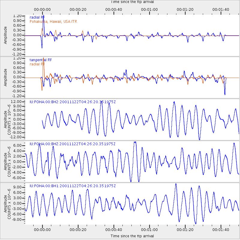
POHA Pohakuloa, Hawaii, USA - Earthquake Result Viewer
*The percent match for this event was below the threshold and hence no stack was calculated.
| Earthquake location: |
Kermadec Islands Region |
| Earthquake latitude/longitude: |
-31.1/-176.7 |
| Earthquake time(UTC): |
2001/11/22 (326) 04:17:26 GMT |
| Earthquake Depth: |
33 km |
| Earthquake Magnitude: |
5.8 MB, 5.7 MS, 5.9 MW, 5.9 MW |
| Earthquake Catalog/Contributor: |
WHDF/NEIC |
|
| Network: |
IU Global Seismograph Network (GSN - IRIS/USGS) |
| Station: |
POHA Pohakuloa, Hawaii, USA |
| Lat/Lon: |
19.76 N/155.53 W |
| Elevation: |
1967 m |
|
| Distance: |
54.5 deg |
| Az: |
24.728 deg |
| Baz: |
202.402 deg |
| Ray Param: |
$rayparam |
*The percent match for this event was below the threshold and hence was not used in the summary stack. |
|
| Radial Match: |
61.74143 % |
| Radial Bump: |
400 |
| Transverse Match: |
66.14671 % |
| Transverse Bump: |
400 |
| SOD ConfigId: |
590571 |
| Insert Time: |
2013-09-24 21:50:22.173 +0000 |
| GWidth: |
2.5 |
| Max Bumps: |
400 |
| Tol: |
0.001 |
|
Signal To Noise
| Channel | StoN | STA | LTA |
| IU:POHA:00:BHZ:20011122T04:26:20.351975Z | 0.976336 | 2.7436622E-6 | 2.810162E-6 |
| IU:POHA:00:BH1:20011122T04:26:20.351975Z | 0.75421524 | 3.93434E-6 | 5.2164683E-6 |
| IU:POHA:00:BH2:20011122T04:26:20.351975Z | 2.1518471 | 7.630381E-6 | 3.5459684E-6 |
| Arrivals |
| Ps | |
| PpPs | |
| PsPs/PpSs | |


