You are here: Home > Network List > IU - Global Seismograph Network (GSN - IRIS/USGS) Stations List
> Station POHA Pohakuloa, Hawaii, USA > Earthquake Result Viewer
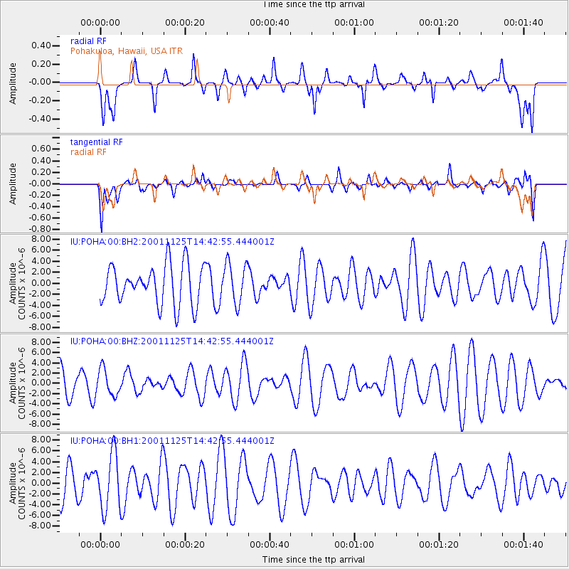
POHA Pohakuloa, Hawaii, USA - Earthquake Result Viewer
*The percent match for this event was below the threshold and hence no stack was calculated.
| Earthquake location: |
Southwestern Ryukyu Isl., Japan |
| Earthquake latitude/longitude: |
23.0/125.4 |
| Earthquake time(UTC): |
2001/11/25 (329) 14:31:57 GMT |
| Earthquake Depth: |
10 km |
| Earthquake Magnitude: |
5.6 MW, 5.6 MW |
| Earthquake Catalog/Contributor: |
NEIC PDE/NEIC PDE-M |
|
| Network: |
IU Global Seismograph Network (GSN - IRIS/USGS) |
| Station: |
POHA Pohakuloa, Hawaii, USA |
| Lat/Lon: |
19.76 N/155.53 W |
| Elevation: |
1967 m |
|
| Distance: |
72.9 deg |
| Az: |
75.434 deg |
| Baz: |
288.795 deg |
| Ray Param: |
$rayparam |
*The percent match for this event was below the threshold and hence was not used in the summary stack. |
|
| Radial Match: |
50.07757 % |
| Radial Bump: |
400 |
| Transverse Match: |
56.02317 % |
| Transverse Bump: |
400 |
| SOD ConfigId: |
590571 |
| Insert Time: |
2013-09-24 21:51:24.673 +0000 |
| GWidth: |
2.5 |
| Max Bumps: |
400 |
| Tol: |
0.001 |
|
Signal To Noise
| Channel | StoN | STA | LTA |
| IU:POHA:00:BHZ:20011125T14:42:55.444001Z | 0.8515475 | 2.5821992E-6 | 3.0323606E-6 |
| IU:POHA:00:BH1:20011125T14:42:55.444001Z | 1.8310957 | 5.2559826E-6 | 2.870403E-6 |
| IU:POHA:00:BH2:20011125T14:42:55.444001Z | 1.0274663 | 3.6801987E-6 | 3.5818196E-6 |
| Arrivals |
| Ps | |
| PpPs | |
| PsPs/PpSs | |


