You are here: Home > Network List > IU - Global Seismograph Network (GSN - IRIS/USGS) Stations List
> Station RSSD Black Hills, South Dakota, USA > Earthquake Result Viewer
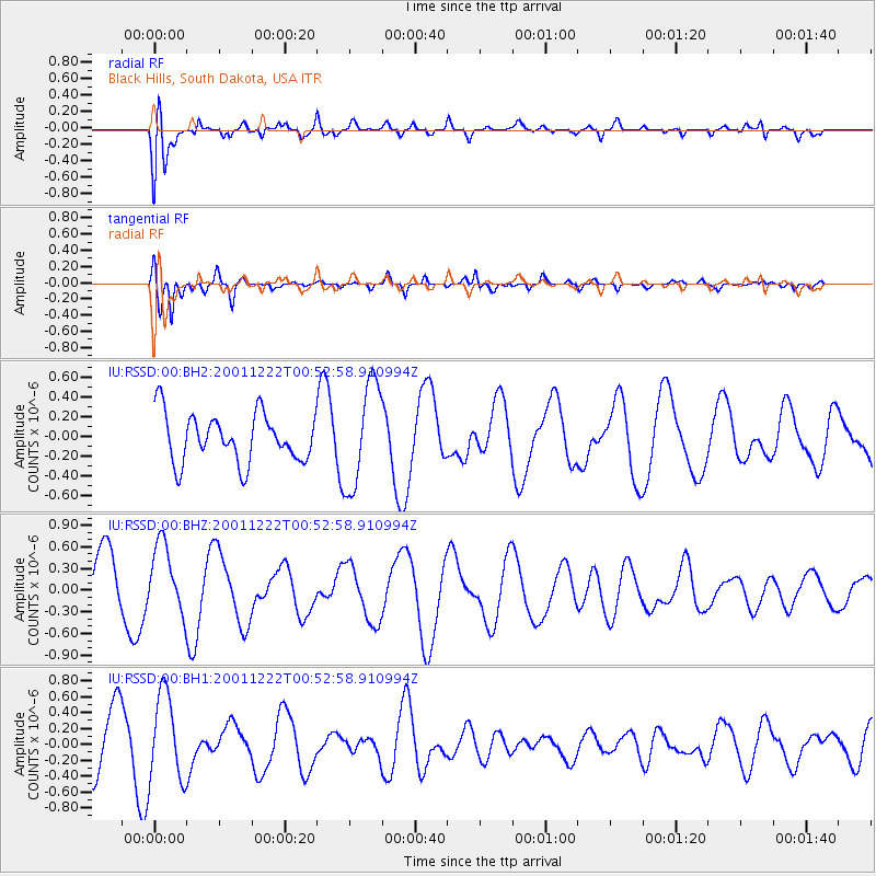
RSSD Black Hills, South Dakota, USA - Earthquake Result Viewer
*The percent match for this event was below the threshold and hence no stack was calculated.
| Earthquake location: |
Santa Cruz Islands |
| Earthquake latitude/longitude: |
-10.9/165.9 |
| Earthquake time(UTC): |
2001/12/22 (356) 00:40:04 GMT |
| Earthquake Depth: |
74 km |
| Earthquake Magnitude: |
5.4 MB, 5.9 MW, 5.9 MW |
| Earthquake Catalog/Contributor: |
WHDF/NEIC |
|
| Network: |
IU Global Seismograph Network (GSN - IRIS/USGS) |
| Station: |
RSSD Black Hills, South Dakota, USA |
| Lat/Lon: |
44.12 N/104.04 W |
| Elevation: |
2060 m |
|
| Distance: |
97.6 deg |
| Az: |
46.597 deg |
| Baz: |
262.218 deg |
| Ray Param: |
$rayparam |
*The percent match for this event was below the threshold and hence was not used in the summary stack. |
|
| Radial Match: |
62.86539 % |
| Radial Bump: |
400 |
| Transverse Match: |
72.90621 % |
| Transverse Bump: |
385 |
| SOD ConfigId: |
590571 |
| Insert Time: |
2013-09-24 22:00:42.671 +0000 |
| GWidth: |
2.5 |
| Max Bumps: |
400 |
| Tol: |
0.001 |
|
Signal To Noise
| Channel | StoN | STA | LTA |
| IU:RSSD:00:BHZ:20011222T00:52:58.910994Z | 1.2108763 | 4.851023E-7 | 4.0062085E-7 |
| IU:RSSD:00:BH1:20011222T00:52:58.910994Z | 1.7365608 | 5.460689E-7 | 3.1445424E-7 |
| IU:RSSD:00:BH2:20011222T00:52:58.910994Z | 2.1643937 | 5.30646E-7 | 2.4517075E-7 |
| Arrivals |
| Ps | |
| PpPs | |
| PsPs/PpSs | |


