You are here: Home > Network List > IU - Global Seismograph Network (GSN - IRIS/USGS) Stations List
> Station JOHN Johnston Island, USA > Earthquake Result Viewer
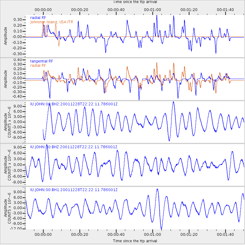
JOHN Johnston Island, USA - Earthquake Result Viewer
*The percent match for this event was below the threshold and hence no stack was calculated.
| Earthquake location: |
Peru-Brazil Border Region |
| Earthquake latitude/longitude: |
-8.4/-74.2 |
| Earthquake time(UTC): |
2001/12/28 (362) 22:09:28 GMT |
| Earthquake Depth: |
161 km |
| Earthquake Magnitude: |
5.5 MB, 6.0 MW |
| Earthquake Catalog/Contributor: |
NEIC PDE/NEIC PDE-M |
|
| Network: |
IU Global Seismograph Network (GSN - IRIS/USGS) |
| Station: |
JOHN Johnston Island, USA |
| Lat/Lon: |
16.73 N/169.53 W |
| Elevation: |
2.0 m |
|
| Distance: |
97.4 deg |
| Az: |
285.82 deg |
| Baz: |
96.494 deg |
| Ray Param: |
$rayparam |
*The percent match for this event was below the threshold and hence was not used in the summary stack. |
|
| Radial Match: |
53.465897 % |
| Radial Bump: |
354 |
| Transverse Match: |
56.335346 % |
| Transverse Bump: |
234 |
| SOD ConfigId: |
590571 |
| Insert Time: |
2013-09-24 22:02:25.513 +0000 |
| GWidth: |
2.5 |
| Max Bumps: |
400 |
| Tol: |
0.001 |
|
Signal To Noise
| Channel | StoN | STA | LTA |
| IU:JOHN:00:BHZ:20011228T22:22:11.786001Z | 1.8387563 | 6.5377817E-6 | 3.5555456E-6 |
| IU:JOHN:00:BH1:20011228T22:22:11.786001Z | 0.61634463 | 3.281171E-6 | 5.323598E-6 |
| IU:JOHN:00:BH2:20011228T22:22:11.786001Z | 0.9385722 | 4.9424393E-6 | 5.2659125E-6 |
| Arrivals |
| Ps | |
| PpPs | |
| PsPs/PpSs | |


