You are here: Home > Network List > IU - Global Seismograph Network (GSN - IRIS/USGS) Stations List
> Station RSSD Black Hills, South Dakota, USA > Earthquake Result Viewer
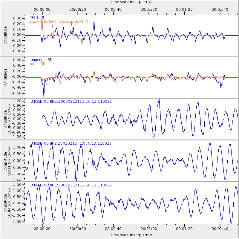
RSSD Black Hills, South Dakota, USA - Earthquake Result Viewer
*The percent match for this event was below the threshold and hence no stack was calculated.
| Earthquake location: |
Near East Coast Of Honshu, Japan |
| Earthquake latitude/longitude: |
36.6/140.9 |
| Earthquake time(UTC): |
2002/02/12 (043) 13:44:37 GMT |
| Earthquake Depth: |
45 km |
| Earthquake Magnitude: |
5.6 MB, 5.6 MW |
| Earthquake Catalog/Contributor: |
NEIC PDE/NEIC PDE-M |
|
| Network: |
IU Global Seismograph Network (GSN - IRIS/USGS) |
| Station: |
RSSD Black Hills, South Dakota, USA |
| Lat/Lon: |
44.12 N/104.04 W |
| Elevation: |
2060 m |
|
| Distance: |
80.4 deg |
| Az: |
41.445 deg |
| Baz: |
312.295 deg |
| Ray Param: |
$rayparam |
*The percent match for this event was below the threshold and hence was not used in the summary stack. |
|
| Radial Match: |
50.75801 % |
| Radial Bump: |
400 |
| Transverse Match: |
89.595924 % |
| Transverse Bump: |
344 |
| SOD ConfigId: |
590571 |
| Insert Time: |
2013-09-24 22:21:10.901 +0000 |
| GWidth: |
2.5 |
| Max Bumps: |
400 |
| Tol: |
0.001 |
|
Signal To Noise
| Channel | StoN | STA | LTA |
| IU:RSSD:00:BHZ:20020212T13:56:13.11002Z | 2.1804779 | 8.79147E-7 | 4.0319006E-7 |
| IU:RSSD:00:BH1:20020212T13:56:13.11002Z | 3.0294724 | 1.0838738E-6 | 3.5777643E-7 |
| IU:RSSD:00:BH2:20020212T13:56:13.11002Z | 1.1456779 | 3.0274765E-7 | 2.6425195E-7 |
| Arrivals |
| Ps | |
| PpPs | |
| PsPs/PpSs | |


