You are here: Home > Network List > II - Global Seismograph Network (GSN - IRIS/IDA) Stations List
> Station PALK Pallekele, Sri Lanka > Earthquake Result Viewer
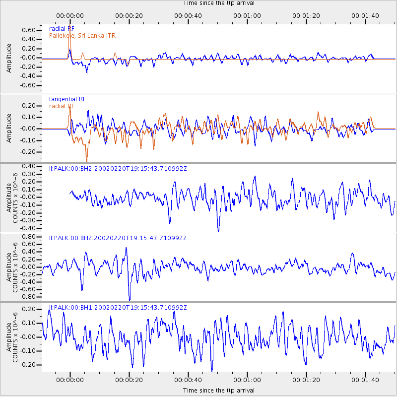
PALK Pallekele, Sri Lanka - Earthquake Result Viewer
*The percent match for this event was below the threshold and hence no stack was calculated.
| Earthquake location: |
Lake Tanganyika Region |
| Earthquake latitude/longitude: |
-7.7/31.9 |
| Earthquake time(UTC): |
2002/02/20 (051) 19:07:17 GMT |
| Earthquake Depth: |
38 km |
| Earthquake Magnitude: |
5.5 MW, 5.5 MW, 5.7 MB |
| Earthquake Catalog/Contributor: |
NEIC PDE/NEIC PDE-M |
|
| Network: |
II Global Seismograph Network (GSN - IRIS/IDA) |
| Station: |
PALK Pallekele, Sri Lanka |
| Lat/Lon: |
7.27 N/80.70 E |
| Elevation: |
460 m |
|
| Distance: |
50.9 deg |
| Az: |
74.191 deg |
| Baz: |
254.006 deg |
| Ray Param: |
$rayparam |
*The percent match for this event was below the threshold and hence was not used in the summary stack. |
|
| Radial Match: |
74.57237 % |
| Radial Bump: |
400 |
| Transverse Match: |
66.05652 % |
| Transverse Bump: |
400 |
| SOD ConfigId: |
590571 |
| Insert Time: |
2013-09-24 22:23:31.487 +0000 |
| GWidth: |
2.5 |
| Max Bumps: |
400 |
| Tol: |
0.001 |
|
Signal To Noise
| Channel | StoN | STA | LTA |
| II:PALK:00:BHZ:20020220T19:15:43.710992Z | 1.7884645 | 2.132565E-7 | 1.1923998E-7 |
| II:PALK:00:BH1:20020220T19:15:43.710992Z | 0.7220117 | 6.01455E-8 | 8.330267E-8 |
| II:PALK:00:BH2:20020220T19:15:43.710992Z | 2.014364 | 1.1952271E-7 | 5.933521E-8 |
| Arrivals |
| Ps | |
| PpPs | |
| PsPs/PpSs | |


