You are here: Home > Network List > IU - Global Seismograph Network (GSN - IRIS/USGS) Stations List
> Station RSSD Black Hills, South Dakota, USA > Earthquake Result Viewer
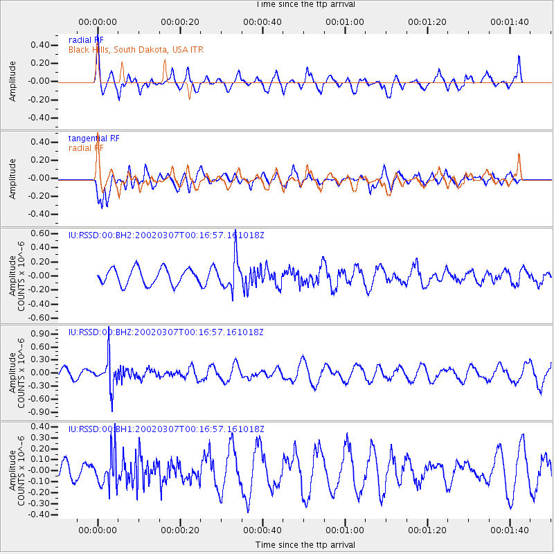
RSSD Black Hills, South Dakota, USA - Earthquake Result Viewer
*The percent match for this event was below the threshold and hence no stack was calculated.
| Earthquake location: |
Northwest Of Kuril Islands |
| Earthquake latitude/longitude: |
47.9/147.0 |
| Earthquake time(UTC): |
2002/03/07 (066) 00:07:06 GMT |
| Earthquake Depth: |
440 km |
| Earthquake Magnitude: |
5.1 MB, 5.6 MW, 5.5 MW |
| Earthquake Catalog/Contributor: |
WHDF/NEIC |
|
| Network: |
IU Global Seismograph Network (GSN - IRIS/USGS) |
| Station: |
RSSD Black Hills, South Dakota, USA |
| Lat/Lon: |
44.12 N/104.04 W |
| Elevation: |
2060 m |
|
| Distance: |
69.2 deg |
| Az: |
46.755 deg |
| Baz: |
317.09 deg |
| Ray Param: |
$rayparam |
*The percent match for this event was below the threshold and hence was not used in the summary stack. |
|
| Radial Match: |
53.982304 % |
| Radial Bump: |
400 |
| Transverse Match: |
68.33961 % |
| Transverse Bump: |
400 |
| SOD ConfigId: |
590571 |
| Insert Time: |
2013-09-24 22:28:02.729 +0000 |
| GWidth: |
2.5 |
| Max Bumps: |
400 |
| Tol: |
0.001 |
|
Signal To Noise
| Channel | StoN | STA | LTA |
| IU:RSSD:00:BHZ:20020307T00:16:57.161018Z | 2.6032484 | 3.367183E-7 | 1.2934544E-7 |
| IU:RSSD:00:BH1:20020307T00:16:57.161018Z | 1.5997909 | 1.4871797E-7 | 9.296088E-8 |
| IU:RSSD:00:BH2:20020307T00:16:57.161018Z | 1.9874755 | 2.2300652E-7 | 1.1220593E-7 |
| Arrivals |
| Ps | |
| PpPs | |
| PsPs/PpSs | |


