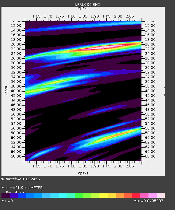
PALK Pallekele, Sri Lanka - Earthquake Result Viewer
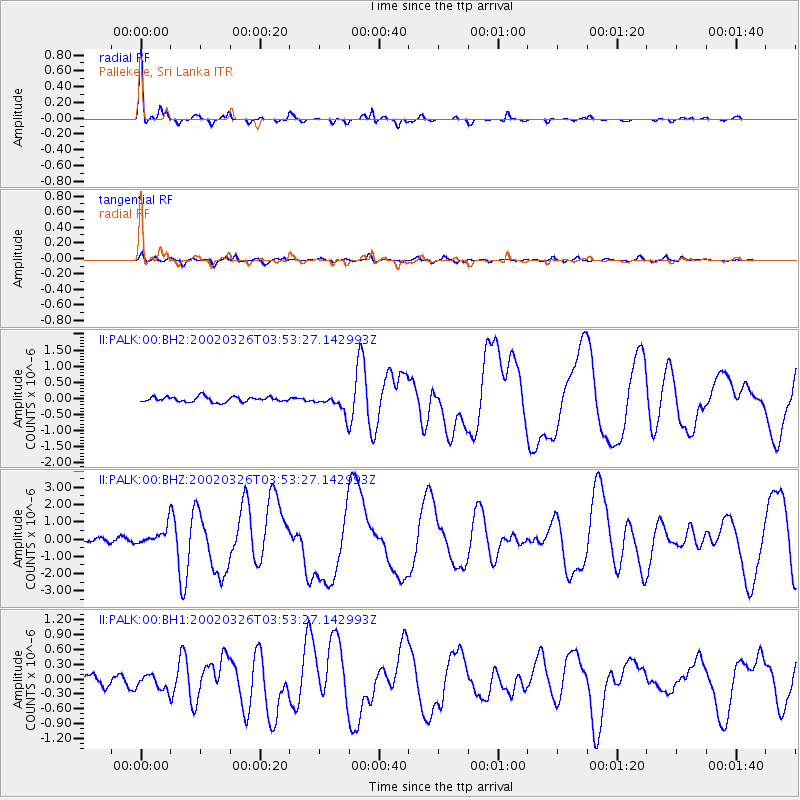
Earthquake location: Southwestern Ryukyu Isl., Japan
Earthquake latitude/longitude: 23.3/124.1
Earthquake time(UTC): 2002/03/26 (085) 03:45:48 GMT
Earthquake Depth: 33 km
Earthquake Magnitude: 5.8 MB, 6.6 MS, 6.4 MW, 6.4 MW
Earthquake Catalog/Contributor: WHDF/NEIC
Network: II Global Seismograph Network (GSN - IRIS/IDA)
Station: PALK Pallekele, Sri Lanka
Lat/Lon: 7.27 N/80.70 E
Elevation: 460 m
Distance: 44.6 deg
Az: 256.112 deg
Baz: 64.074 deg
Ray Param: 0.071760565
Estimated Moho Depth: 21.0 km
Estimated Crust Vp/Vs: 1.94
Assumed Crust Vp: 6.545 km/s
Estimated Crust Vs: 3.378 km/s
Estimated Crust Poisson's Ratio: 0.32
Radial Match: 91.892456 %
Radial Bump: 269
Transverse Match: 74.47344 %
Transverse Bump: 400
SOD ConfigId: 590571
Insert Time: 2013-09-24 22:37:36.937 +0000
GWidth: 2.5
Max Bumps: 400
Tol: 0.001

Signal To Noise

ChannelStoNSTALTA
II:PALK:00:BHZ:20020326T03:53:27.142993Z5.1547225.3609887E-71.040015E-7
II:PALK:00:BH1:20020326T03:53:27.142993Z1.22131631.5068937E-71.2338275E-7
II:PALK:00:BH2:20020326T03:53:27.142993Z3.5603022.836268E-77.966369E-8
Arrivals
Ps3.2 SECOND
PpPs8.9 SECOND
PsPs/PpSs12 SECOND