You are here: Home > Network List > IU - Global Seismograph Network (GSN - IRIS/USGS) Stations List
> Station POHA Pohakuloa, Hawaii, USA > Earthquake Result Viewer
POHA Pohakuloa, Hawaii, USA - Earthquake Result Viewer
*The percent match for this event was below the threshold and hence no stack was calculated.
| Earthquake location: |
South Of Mariana Islands |
| Earthquake latitude/longitude: |
13.1/143.8 |
| Earthquake time(UTC): |
2002/04/15 (105) 03:52:06 GMT |
| Earthquake Depth: |
117 km |
| Earthquake Magnitude: |
5.5 MB |
| Earthquake Catalog/Contributor: |
NEIC PDE/NEIC PDE-M |
|
| Network: |
IU Global Seismograph Network (GSN - IRIS/USGS) |
| Station: |
POHA Pohakuloa, Hawaii, USA |
| Lat/Lon: |
19.76 N/155.53 W |
| Elevation: |
1967 m |
|
| Distance: |
58.3 deg |
| Az: |
74.761 deg |
| Baz: |
273.464 deg |
| Ray Param: |
$rayparam |
*The percent match for this event was below the threshold and hence was not used in the summary stack. |
|
| Radial Match: |
74.63649 % |
| Radial Bump: |
400 |
| Transverse Match: |
84.605606 % |
| Transverse Bump: |
382 |
| SOD ConfigId: |
590571 |
| Insert Time: |
2013-09-24 22:45:29.293 +0000 |
| GWidth: |
2.5 |
| Max Bumps: |
400 |
| Tol: |
0.001 |
|
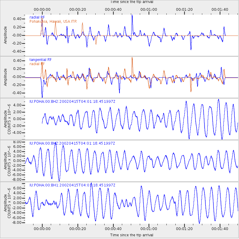
Signal To Noise
| Channel | StoN | STA | LTA |
| IU:POHA:00:BHZ:20020415T04:01:18.451997Z | 3.2715752 | 4.067263E-6 | 1.2432124E-6 |
| IU:POHA:00:BH1:20020415T04:01:18.451997Z | 0.31607422 | 6.388768E-7 | 2.0212874E-6 |
| IU:POHA:00:BH2:20020415T04:01:18.451997Z | 1.8470826 | 2.2725912E-6 | 1.230368E-6 |
| Arrivals |
| Ps | |
| PpPs | |
| PsPs/PpSs | |


