You are here: Home > Network List > IU - Global Seismograph Network (GSN - IRIS/USGS) Stations List
> Station RSSD Black Hills, South Dakota, USA > Earthquake Result Viewer
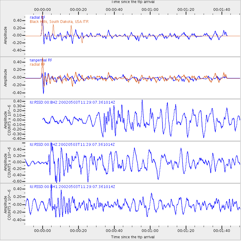
RSSD Black Hills, South Dakota, USA - Earthquake Result Viewer
*The percent match for this event was below the threshold and hence no stack was calculated.
| Earthquake location: |
North Of Svalbard |
| Earthquake latitude/longitude: |
86.0/31.6 |
| Earthquake time(UTC): |
2002/05/03 (123) 11:20:51 GMT |
| Earthquake Depth: |
10 km |
| Earthquake Magnitude: |
5.6 MW |
| Earthquake Catalog/Contributor: |
NEIC PDE/NEIC PDE-M |
|
| Network: |
IU Global Seismograph Network (GSN - IRIS/USGS) |
| Station: |
RSSD Black Hills, South Dakota, USA |
| Lat/Lon: |
44.12 N/104.04 W |
| Elevation: |
2060 m |
|
| Distance: |
49.0 deg |
| Az: |
318.147 deg |
| Baz: |
3.725 deg |
| Ray Param: |
$rayparam |
*The percent match for this event was below the threshold and hence was not used in the summary stack. |
|
| Radial Match: |
73.71463 % |
| Radial Bump: |
400 |
| Transverse Match: |
50.90906 % |
| Transverse Bump: |
400 |
| SOD ConfigId: |
590571 |
| Insert Time: |
2013-09-24 22:52:53.434 +0000 |
| GWidth: |
2.5 |
| Max Bumps: |
400 |
| Tol: |
0.001 |
|
Signal To Noise
| Channel | StoN | STA | LTA |
| IU:RSSD:00:BHZ:20020503T11:29:07.361014Z | 2.447825 | 1.7665458E-7 | 7.216798E-8 |
| IU:RSSD:00:BH1:20020503T11:29:07.361014Z | 1.2451912 | 1.4053417E-7 | 1.12861514E-7 |
| IU:RSSD:00:BH2:20020503T11:29:07.361014Z | 3.5054655 | 1.6132745E-7 | 4.602169E-8 |
| Arrivals |
| Ps | |
| PpPs | |
| PsPs/PpSs | |


