You are here: Home > Network List > IU - Global Seismograph Network (GSN - IRIS/USGS) Stations List
> Station RSSD Black Hills, South Dakota, USA > Earthquake Result Viewer
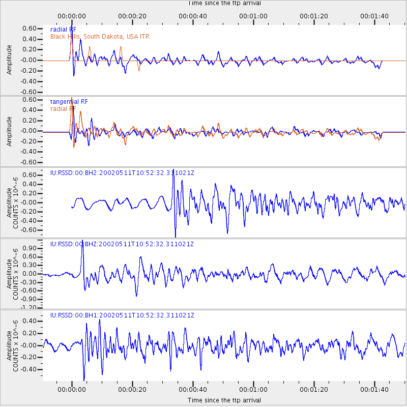
RSSD Black Hills, South Dakota, USA - Earthquake Result Viewer
*The percent match for this event was below the threshold and hence no stack was calculated.
| Earthquake location: |
Near Coast Of Peru |
| Earthquake latitude/longitude: |
-10.4/-78.5 |
| Earthquake time(UTC): |
2002/05/11 (131) 10:43:07 GMT |
| Earthquake Depth: |
47 km |
| Earthquake Magnitude: |
5.5 MB, 5.0 MS, 5.7 MW, 5.7 MW |
| Earthquake Catalog/Contributor: |
WHDF/NEIC |
|
| Network: |
IU Global Seismograph Network (GSN - IRIS/USGS) |
| Station: |
RSSD Black Hills, South Dakota, USA |
| Lat/Lon: |
44.12 N/104.04 W |
| Elevation: |
2060 m |
|
| Distance: |
59.0 deg |
| Az: |
338.776 deg |
| Baz: |
150.366 deg |
| Ray Param: |
$rayparam |
*The percent match for this event was below the threshold and hence was not used in the summary stack. |
|
| Radial Match: |
72.9374 % |
| Radial Bump: |
400 |
| Transverse Match: |
81.195244 % |
| Transverse Bump: |
400 |
| SOD ConfigId: |
590571 |
| Insert Time: |
2013-09-24 22:56:23.762 +0000 |
| GWidth: |
2.5 |
| Max Bumps: |
400 |
| Tol: |
0.001 |
|
Signal To Noise
| Channel | StoN | STA | LTA |
| IU:RSSD:00:BHZ:20020511T10:52:32.311021Z | 5.7144294 | 3.9994964E-7 | 6.998943E-8 |
| IU:RSSD:00:BH1:20020511T10:52:32.311021Z | 2.2803068 | 1.7566202E-7 | 7.7034386E-8 |
| IU:RSSD:00:BH2:20020511T10:52:32.311021Z | 3.7492504 | 2.9051802E-7 | 7.748696E-8 |
| Arrivals |
| Ps | |
| PpPs | |
| PsPs/PpSs | |


