You are here: Home > Network List > IU - Global Seismograph Network (GSN - IRIS/USGS) Stations List
> Station POHA Pohakuloa, Hawaii, USA > Earthquake Result Viewer
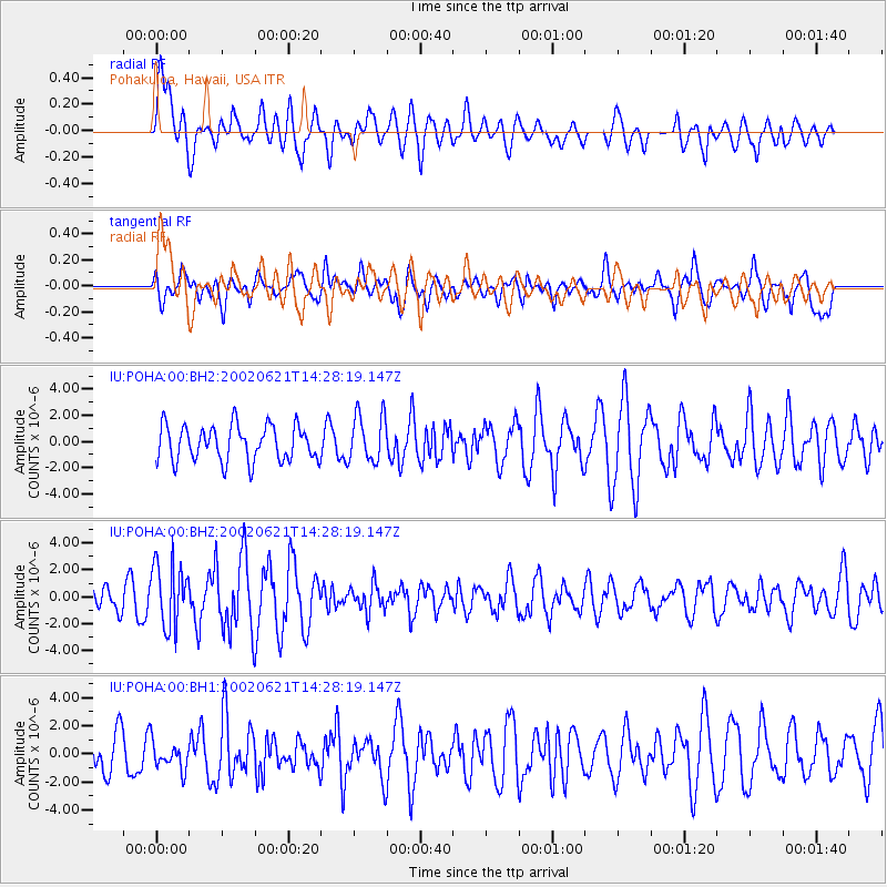
POHA Pohakuloa, Hawaii, USA - Earthquake Result Viewer
*The percent match for this event was below the threshold and hence no stack was calculated.
| Earthquake location: |
Tonga Islands |
| Earthquake latitude/longitude: |
-15.1/-175.9 |
| Earthquake time(UTC): |
2002/06/21 (172) 14:21:44 GMT |
| Earthquake Depth: |
319 km |
| Earthquake Magnitude: |
5.7 MB, 5.7 MW, 5.7 MW |
| Earthquake Catalog/Contributor: |
WHDF/NEIC |
|
| Network: |
IU Global Seismograph Network (GSN - IRIS/USGS) |
| Station: |
POHA Pohakuloa, Hawaii, USA |
| Lat/Lon: |
19.76 N/155.53 W |
| Elevation: |
1967 m |
|
| Distance: |
40.0 deg |
| Az: |
30.599 deg |
| Baz: |
211.467 deg |
| Ray Param: |
$rayparam |
*The percent match for this event was below the threshold and hence was not used in the summary stack. |
|
| Radial Match: |
65.41541 % |
| Radial Bump: |
400 |
| Transverse Match: |
56.107292 % |
| Transverse Bump: |
400 |
| SOD ConfigId: |
590571 |
| Insert Time: |
2013-09-24 23:17:19.874 +0000 |
| GWidth: |
2.5 |
| Max Bumps: |
400 |
| Tol: |
0.001 |
|
Signal To Noise
| Channel | StoN | STA | LTA |
| IU:POHA:00:BHZ:20020621T14:28:19.147Z | 2.224428 | 2.3642565E-6 | 1.0628605E-6 |
| IU:POHA:00:BH1:20020621T14:28:19.147Z | 0.6014584 | 9.949056E-7 | 1.6541554E-6 |
| IU:POHA:00:BH2:20020621T14:28:19.147Z | 1.3621445 | 1.8313958E-6 | 1.3444945E-6 |
| Arrivals |
| Ps | |
| PpPs | |
| PsPs/PpSs | |


