You are here: Home > Network List > TA - USArray Transportable Network (new EarthScope stations) Stations List
> Station V61A Roper, NC, USA > Earthquake Result Viewer
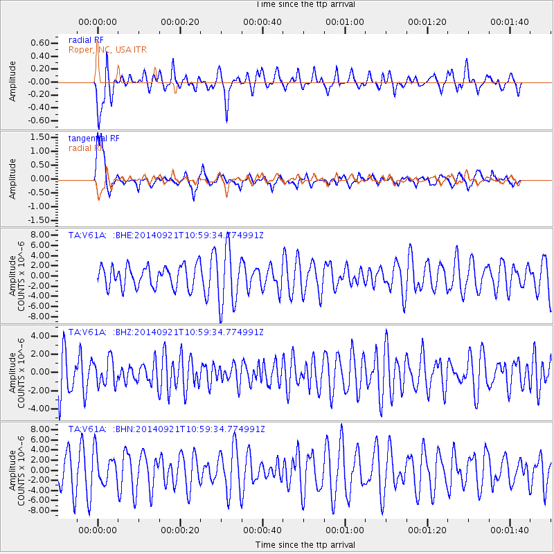
V61A Roper, NC, USA - Earthquake Result Viewer
*The percent match for this event was below the threshold and hence no stack was calculated.
| Earthquake location: |
Iceland |
| Earthquake latitude/longitude: |
64.5/-17.4 |
| Earthquake time(UTC): |
2014/09/21 (264) 10:51:47 GMT |
| Earthquake Depth: |
2.6 km |
| Earthquake Magnitude: |
5.5 MW |
| Earthquake Catalog/Contributor: |
ISC/ISC |
|
| Network: |
TA USArray Transportable Network (new EarthScope stations) |
| Station: |
V61A Roper, NC, USA |
| Lat/Lon: |
35.79 N/76.58 W |
| Elevation: |
4.0 m |
|
| Distance: |
45.2 deg |
| Az: |
259.971 deg |
| Baz: |
31.587 deg |
| Ray Param: |
$rayparam |
*The percent match for this event was below the threshold and hence was not used in the summary stack. |
|
| Radial Match: |
55.32582 % |
| Radial Bump: |
400 |
| Transverse Match: |
60.596283 % |
| Transverse Bump: |
400 |
| SOD ConfigId: |
3390531 |
| Insert Time: |
2019-04-14 03:32:21.411 +0000 |
| GWidth: |
2.5 |
| Max Bumps: |
400 |
| Tol: |
0.001 |
|
Signal To Noise
| Channel | StoN | STA | LTA |
| TA:V61A: :BHZ:20140921T10:59:34.774991Z | 0.8679019 | 1.4146735E-6 | 1.6299923E-6 |
| TA:V61A: :BHN:20140921T10:59:34.774991Z | 0.83279717 | 3.1631273E-6 | 3.7981965E-6 |
| TA:V61A: :BHE:20140921T10:59:34.774991Z | 2.7022405 | 5.643304E-6 | 2.08838E-6 |
| Arrivals |
| Ps | |
| PpPs | |
| PsPs/PpSs | |


