You are here: Home > Network List > IU - Global Seismograph Network (GSN - IRIS/USGS) Stations List
> Station RSSD Black Hills, South Dakota, USA > Earthquake Result Viewer
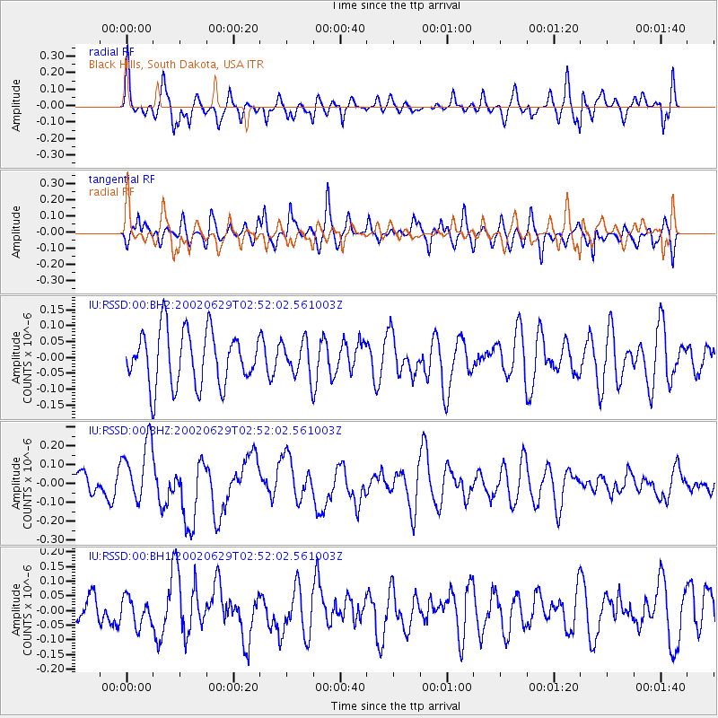
RSSD Black Hills, South Dakota, USA - Earthquake Result Viewer
*The percent match for this event was below the threshold and hence no stack was calculated.
| Earthquake location: |
Santa Cruz Islands |
| Earthquake latitude/longitude: |
-12.4/166.5 |
| Earthquake time(UTC): |
2002/06/29 (180) 02:39:00 GMT |
| Earthquake Depth: |
33 km |
| Earthquake Magnitude: |
5.9 MB, 5.9 MS, 6.2 MW, 6.1 MW |
| Earthquake Catalog/Contributor: |
WHDF/NEIC |
|
| Network: |
IU Global Seismograph Network (GSN - IRIS/USGS) |
| Station: |
RSSD Black Hills, South Dakota, USA |
| Lat/Lon: |
44.12 N/104.04 W |
| Elevation: |
2060 m |
|
| Distance: |
98.1 deg |
| Az: |
46.674 deg |
| Baz: |
260.682 deg |
| Ray Param: |
$rayparam |
*The percent match for this event was below the threshold and hence was not used in the summary stack. |
|
| Radial Match: |
58.23121 % |
| Radial Bump: |
400 |
| Transverse Match: |
49.636 % |
| Transverse Bump: |
400 |
| SOD ConfigId: |
590571 |
| Insert Time: |
2013-09-24 23:20:55.348 +0000 |
| GWidth: |
2.5 |
| Max Bumps: |
400 |
| Tol: |
0.001 |
|
Signal To Noise
| Channel | StoN | STA | LTA |
| IU:RSSD:00:BHZ:20020629T02:52:02.561003Z | 3.5432074 | 1.6401623E-7 | 4.6290328E-8 |
| IU:RSSD:00:BH1:20020629T02:52:02.561003Z | 0.50686955 | 4.758579E-8 | 9.3881724E-8 |
| IU:RSSD:00:BH2:20020629T02:52:02.561003Z | 0.6448057 | 5.5049064E-8 | 8.5373095E-8 |
| Arrivals |
| Ps | |
| PpPs | |
| PsPs/PpSs | |


