You are here: Home > Network List > IU - Global Seismograph Network (GSN - IRIS/USGS) Stations List
> Station RSSD Black Hills, South Dakota, USA > Earthquake Result Viewer
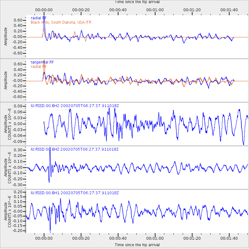
RSSD Black Hills, South Dakota, USA - Earthquake Result Viewer
*The percent match for this event was below the threshold and hence no stack was calculated.
| Earthquake location: |
Fiji Islands Region |
| Earthquake latitude/longitude: |
-20.6/-177.2 |
| Earthquake time(UTC): |
2002/07/05 (186) 06:15:28 GMT |
| Earthquake Depth: |
280 km |
| Earthquake Magnitude: |
5.7 MW, 5.2 MB |
| Earthquake Catalog/Contributor: |
WHDF/NEIC |
|
| Network: |
IU Global Seismograph Network (GSN - IRIS/USGS) |
| Station: |
RSSD Black Hills, South Dakota, USA |
| Lat/Lon: |
44.12 N/104.04 W |
| Elevation: |
2060 m |
|
| Distance: |
92.7 deg |
| Az: |
43.627 deg |
| Baz: |
243.812 deg |
| Ray Param: |
$rayparam |
*The percent match for this event was below the threshold and hence was not used in the summary stack. |
|
| Radial Match: |
60.319714 % |
| Radial Bump: |
400 |
| Transverse Match: |
65.11117 % |
| Transverse Bump: |
400 |
| SOD ConfigId: |
590571 |
| Insert Time: |
2013-09-24 23:23:28.295 +0000 |
| GWidth: |
2.5 |
| Max Bumps: |
400 |
| Tol: |
0.001 |
|
Signal To Noise
| Channel | StoN | STA | LTA |
| IU:RSSD:00:BHZ:20020705T06:27:37.911018Z | 3.2855837 | 1.05522716E-7 | 3.2116883E-8 |
| IU:RSSD:00:BH1:20020705T06:27:37.911018Z | 1.9914087 | 6.564571E-8 | 3.2964458E-8 |
| IU:RSSD:00:BH2:20020705T06:27:37.911018Z | 1.0121435 | 3.666734E-8 | 3.6227416E-8 |
| Arrivals |
| Ps | |
| PpPs | |
| PsPs/PpSs | |


