You are here: Home > Network List > IU - Global Seismograph Network (GSN - IRIS/USGS) Stations List
> Station POHA Pohakuloa, Hawaii, USA > Earthquake Result Viewer
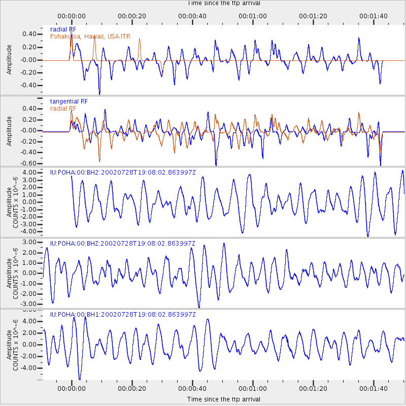
POHA Pohakuloa, Hawaii, USA - Earthquake Result Viewer
*The percent match for this event was below the threshold and hence no stack was calculated.
| Earthquake location: |
Fiji Islands Region |
| Earthquake latitude/longitude: |
-17.9/-178.3 |
| Earthquake time(UTC): |
2002/07/28 (209) 19:01:19 GMT |
| Earthquake Depth: |
580 km |
| Earthquake Magnitude: |
5.5 MW |
| Earthquake Catalog/Contributor: |
NEIC PDE/NEIC PDE-M |
|
| Network: |
IU Global Seismograph Network (GSN - IRIS/USGS) |
| Station: |
POHA Pohakuloa, Hawaii, USA |
| Lat/Lon: |
19.76 N/155.53 W |
| Elevation: |
1967 m |
|
| Distance: |
43.6 deg |
| Az: |
31.943 deg |
| Baz: |
212.33 deg |
| Ray Param: |
$rayparam |
*The percent match for this event was below the threshold and hence was not used in the summary stack. |
|
| Radial Match: |
59.7387 % |
| Radial Bump: |
334 |
| Transverse Match: |
57.42742 % |
| Transverse Bump: |
387 |
| SOD ConfigId: |
590571 |
| Insert Time: |
2013-09-24 23:29:12.475 +0000 |
| GWidth: |
2.5 |
| Max Bumps: |
400 |
| Tol: |
0.001 |
|
Signal To Noise
| Channel | StoN | STA | LTA |
| IU:POHA:00:BHZ:20020728T19:08:02.863997Z | 0.67961407 | 1.012322E-6 | 1.489554E-6 |
| IU:POHA:00:BH1:20020728T19:08:02.863997Z | 2.9799085 | 3.6058068E-6 | 1.2100394E-6 |
| IU:POHA:00:BH2:20020728T19:08:02.863997Z | 0.49921596 | 8.65238E-7 | 1.7331938E-6 |
| Arrivals |
| Ps | |
| PpPs | |
| PsPs/PpSs | |


