You are here: Home > Network List > IU - Global Seismograph Network (GSN - IRIS/USGS) Stations List
> Station JOHN Johnston Island, USA > Earthquake Result Viewer
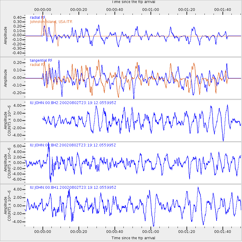
JOHN Johnston Island, USA - Earthquake Result Viewer
*The percent match for this event was below the threshold and hence no stack was calculated.
| Earthquake location: |
Southeast Of Honshu, Japan |
| Earthquake latitude/longitude: |
29.3/139.0 |
| Earthquake time(UTC): |
2002/08/02 (214) 23:11:39 GMT |
| Earthquake Depth: |
426 km |
| Earthquake Magnitude: |
5.5 MB, 6.3 MW, 6.3 MW |
| Earthquake Catalog/Contributor: |
WHDF/NEIC |
|
| Network: |
IU Global Seismograph Network (GSN - IRIS/USGS) |
| Station: |
JOHN Johnston Island, USA |
| Lat/Lon: |
16.73 N/169.53 W |
| Elevation: |
2.0 m |
|
| Distance: |
48.7 deg |
| Az: |
93.072 deg |
| Baz: |
294.433 deg |
| Ray Param: |
$rayparam |
*The percent match for this event was below the threshold and hence was not used in the summary stack. |
|
| Radial Match: |
44.559788 % |
| Radial Bump: |
315 |
| Transverse Match: |
53.976414 % |
| Transverse Bump: |
400 |
| SOD ConfigId: |
590571 |
| Insert Time: |
2013-09-24 23:31:48.309 +0000 |
| GWidth: |
2.5 |
| Max Bumps: |
400 |
| Tol: |
0.001 |
|
Signal To Noise
| Channel | StoN | STA | LTA |
| IU:JOHN:00:BHZ:20020802T23:19:12.055995Z | 2.5843549 | 3.1725124E-6 | 1.2275839E-6 |
| IU:JOHN:00:BH1:20020802T23:19:12.055995Z | 0.99690586 | 1.3390184E-6 | 1.3431744E-6 |
| IU:JOHN:00:BH2:20020802T23:19:12.055995Z | 2.839539 | 2.3423052E-6 | 8.2488924E-7 |
| Arrivals |
| Ps | |
| PpPs | |
| PsPs/PpSs | |


