You are here: Home > Network List > IU - Global Seismograph Network (GSN - IRIS/USGS) Stations List
> Station RSSD Black Hills, South Dakota, USA > Earthquake Result Viewer
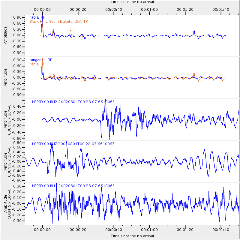
RSSD Black Hills, South Dakota, USA - Earthquake Result Viewer
*The percent match for this event was below the threshold and hence no stack was calculated.
| Earthquake location: |
Near Coast Of Nicaragua |
| Earthquake latitude/longitude: |
11.4/-87.3 |
| Earthquake time(UTC): |
2002/08/04 (216) 00:21:42 GMT |
| Earthquake Depth: |
33 km |
| Earthquake Magnitude: |
5.5 MW, 5.6 MW |
| Earthquake Catalog/Contributor: |
NEIC PDE/NEIC PDE-M |
|
| Network: |
IU Global Seismograph Network (GSN - IRIS/USGS) |
| Station: |
RSSD Black Hills, South Dakota, USA |
| Lat/Lon: |
44.12 N/104.04 W |
| Elevation: |
2060 m |
|
| Distance: |
35.7 deg |
| Az: |
339.185 deg |
| Baz: |
151.064 deg |
| Ray Param: |
$rayparam |
*The percent match for this event was below the threshold and hence was not used in the summary stack. |
|
| Radial Match: |
77.04698 % |
| Radial Bump: |
192 |
| Transverse Match: |
65.85427 % |
| Transverse Bump: |
400 |
| SOD ConfigId: |
590571 |
| Insert Time: |
2013-09-24 23:33:02.896 +0000 |
| GWidth: |
2.5 |
| Max Bumps: |
400 |
| Tol: |
0.001 |
|
Signal To Noise
| Channel | StoN | STA | LTA |
| IU:RSSD:00:BHZ:20020804T00:28:07.661006Z | 2.7030897 | 2.064276E-7 | 7.636728E-8 |
| IU:RSSD:00:BH1:20020804T00:28:07.661006Z | 1.9738779 | 9.028366E-8 | 4.5739235E-8 |
| IU:RSSD:00:BH2:20020804T00:28:07.661006Z | 4.7507215 | 1.9316103E-7 | 4.0659305E-8 |
| Arrivals |
| Ps | |
| PpPs | |
| PsPs/PpSs | |


