You are here: Home > Network List > US - United States National Seismic Network Stations List
> Station HDIL Hopedale, Illinois, USA > Earthquake Result Viewer
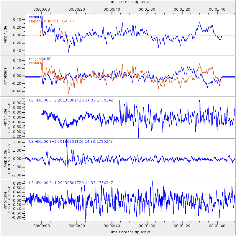
HDIL Hopedale, Illinois, USA - Earthquake Result Viewer
*The percent match for this event was below the threshold and hence no stack was calculated.
| Earthquake location: |
Tonga Islands |
| Earthquake latitude/longitude: |
-15.2/-173.5 |
| Earthquake time(UTC): |
2013/08/01 (213) 20:01:43 GMT |
| Earthquake Depth: |
32 km |
| Earthquake Magnitude: |
6.0 MW, 5.8 MW, 5.9 MS, 6.1 MB |
| Earthquake Catalog/Contributor: |
NEIC PDE/NEIC PDE-W |
|
| Network: |
US United States National Seismic Network |
| Station: |
HDIL Hopedale, Illinois, USA |
| Lat/Lon: |
40.56 N/89.29 W |
| Elevation: |
219 m |
|
| Distance: |
95.5 deg |
| Az: |
49.594 deg |
| Baz: |
254.73 deg |
| Ray Param: |
$rayparam |
*The percent match for this event was below the threshold and hence was not used in the summary stack. |
|
| Radial Match: |
54.546158 % |
| Radial Bump: |
400 |
| Transverse Match: |
65.43154 % |
| Transverse Bump: |
400 |
| SOD ConfigId: |
589702 |
| Insert Time: |
2013-09-24 23:34:04.969 +0000 |
| GWidth: |
2.5 |
| Max Bumps: |
400 |
| Tol: |
0.001 |
|
Signal To Noise
| Channel | StoN | STA | LTA |
| US:HDIL:00:BHZ:20130801T20:14:33.175024Z | 4.3730927 | 4.550913E-7 | 1.0406623E-7 |
| US:HDIL:00:BH1:20130801T20:14:33.175024Z | 1.2360237 | 1.8997635E-7 | 1.536996E-7 |
| US:HDIL:00:BH2:20130801T20:14:33.175024Z | 0.71304005 | 1.8809212E-7 | 2.63789E-7 |
| Arrivals |
| Ps | |
| PpPs | |
| PsPs/PpSs | |


