You are here: Home > Network List > IU - Global Seismograph Network (GSN - IRIS/USGS) Stations List
> Station RSSD Black Hills, South Dakota, USA > Earthquake Result Viewer
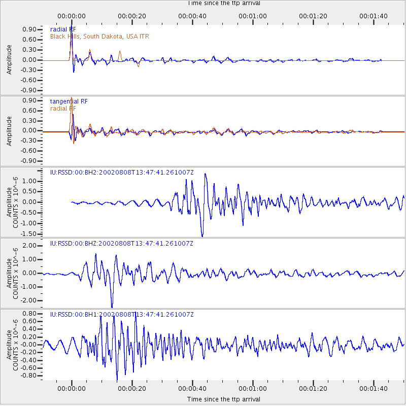
RSSD Black Hills, South Dakota, USA - Earthquake Result Viewer
*The percent match for this event was below the threshold and hence no stack was calculated.
| Earthquake location: |
Near West Coast Of Colombia |
| Earthquake latitude/longitude: |
5.0/-77.8 |
| Earthquake time(UTC): |
2002/08/08 (220) 13:39:58 GMT |
| Earthquake Depth: |
43 km |
| Earthquake Magnitude: |
5.4 MB, 5.0 MS, 5.9 MW, 5.7 MW |
| Earthquake Catalog/Contributor: |
WHDF/NEIC |
|
| Network: |
IU Global Seismograph Network (GSN - IRIS/USGS) |
| Station: |
RSSD Black Hills, South Dakota, USA |
| Lat/Lon: |
44.12 N/104.04 W |
| Elevation: |
2060 m |
|
| Distance: |
45.3 deg |
| Az: |
333.403 deg |
| Baz: |
141.733 deg |
| Ray Param: |
$rayparam |
*The percent match for this event was below the threshold and hence was not used in the summary stack. |
|
| Radial Match: |
94.16845 % |
| Radial Bump: |
326 |
| Transverse Match: |
78.27679 % |
| Transverse Bump: |
400 |
| SOD ConfigId: |
590571 |
| Insert Time: |
2013-09-24 23:35:34.819 +0000 |
| GWidth: |
2.5 |
| Max Bumps: |
400 |
| Tol: |
0.001 |
|
Signal To Noise
| Channel | StoN | STA | LTA |
| IU:RSSD:00:BHZ:20020808T13:47:41.261007Z | 6.7537003 | 3.2853856E-7 | 4.8645713E-8 |
| IU:RSSD:00:BH1:20020808T13:47:41.261007Z | 2.1582701 | 1.6603154E-7 | 7.692807E-8 |
| IU:RSSD:00:BH2:20020808T13:47:41.261007Z | 3.4966373 | 2.0405759E-7 | 5.8358236E-8 |
| Arrivals |
| Ps | |
| PpPs | |
| PsPs/PpSs | |


