LON Longmire (broad-band and DWWSSN) - Earthquake Result Viewer
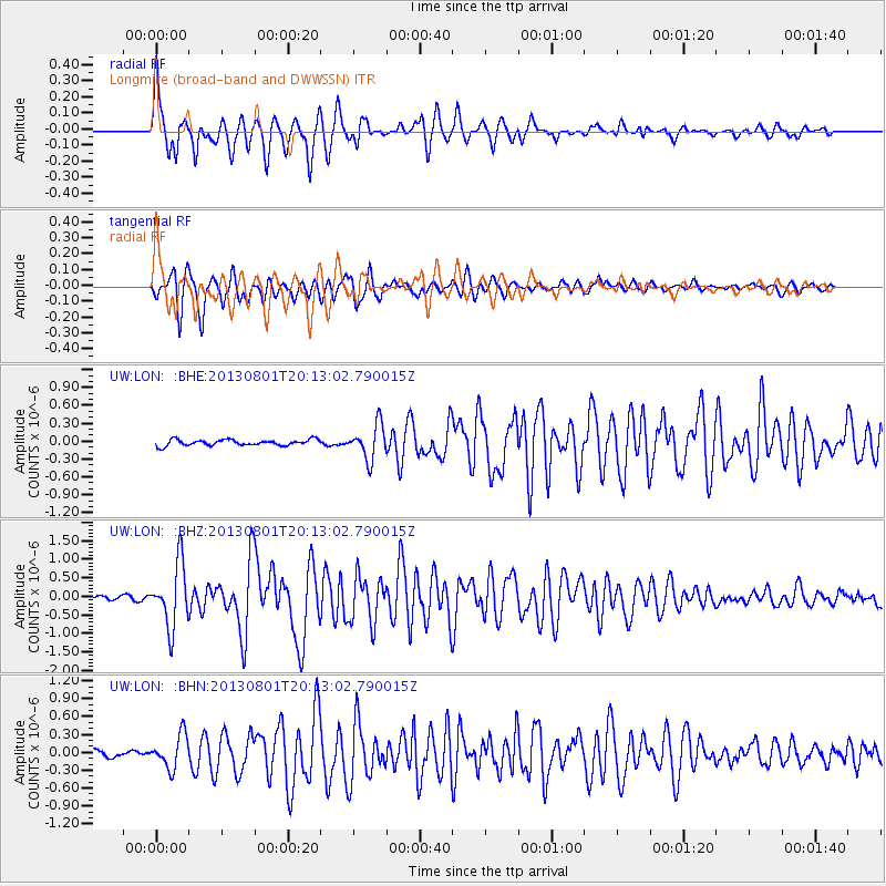
Earthquake location: Tonga Islands
Earthquake latitude/longitude: -15.2/-173.5
Earthquake time(UTC): 2013/08/01 (213) 20:01:43 GMT
Earthquake Depth: 32 km
Earthquake Magnitude: 6.0 MW, 5.8 MW, 5.9 MS, 6.1 MB
Earthquake Catalog/Contributor: NEIC PDE/NEIC PDE-W
Network: UW Pacific Northwest Regional Seismic Network
Station: LON Longmire (broad-band and DWWSSN)
Lat/Lon: 46.75 N/121.81 W
Elevation: 850 m
Distance: 77.2 deg
Az: 33.596 deg
Baz: 230.964 deg
Ray Param: 0.05044776
Estimated Moho Depth: 31.75 km
Estimated Crust Vp/Vs: 1.78
Assumed Crust Vp: 6.597 km/s
Estimated Crust Vs: 3.706 km/s
Estimated Crust Poisson's Ratio: 0.27
Radial Match: 94.07001 %
Radial Bump: 400
Transverse Match: 90.10855 %
Transverse Bump: 400
SOD ConfigId: 589702
Insert Time: 2013-09-24 23:36:47.438 +0000
GWidth: 2.5
Max Bumps: 400
Tol: 0.001

Signal To Noise

ChannelStoNSTALTA
UW:LON: :BHZ:20130801T20:13:02.790015Z17.3514868.470615E-74.8817803E-8
UW:LON: :BHN:20130801T20:13:02.790015Z5.7244422.8009546E-74.892974E-8
UW:LON: :BHE:20130801T20:13:02.790015Z5.77670242.902637E-75.0247298E-8
Arrivals
Ps3.9 SECOND
PpPs13 SECOND
PsPs/PpSs17 SECOND