You are here: Home > Network List > IU - Global Seismograph Network (GSN - IRIS/USGS) Stations List
> Station RSSD Black Hills, South Dakota, USA > Earthquake Result Viewer
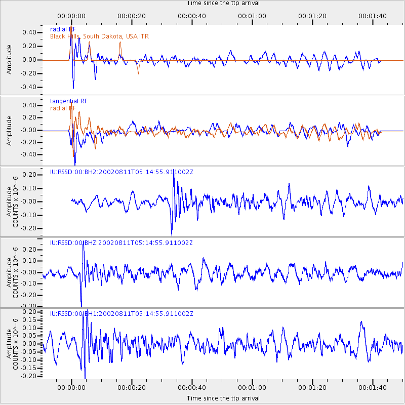
RSSD Black Hills, South Dakota, USA - Earthquake Result Viewer
*The percent match for this event was below the threshold and hence no stack was calculated.
| Earthquake location: |
Western Brazil |
| Earthquake latitude/longitude: |
-5.6/-71.9 |
| Earthquake time(UTC): |
2002/08/11 (223) 05:06:32 GMT |
| Earthquake Depth: |
568 km |
| Earthquake Magnitude: |
5.5 MW |
| Earthquake Catalog/Contributor: |
NEIC PDE/NEIC PDE-M |
|
| Network: |
IU Global Seismograph Network (GSN - IRIS/USGS) |
| Station: |
RSSD Black Hills, South Dakota, USA |
| Lat/Lon: |
44.12 N/104.04 W |
| Elevation: |
2060 m |
|
| Distance: |
57.3 deg |
| Az: |
332.911 deg |
| Baz: |
140.999 deg |
| Ray Param: |
$rayparam |
*The percent match for this event was below the threshold and hence was not used in the summary stack. |
|
| Radial Match: |
56.538822 % |
| Radial Bump: |
400 |
| Transverse Match: |
58.037426 % |
| Transverse Bump: |
400 |
| SOD ConfigId: |
590571 |
| Insert Time: |
2013-09-24 23:37:19.945 +0000 |
| GWidth: |
2.5 |
| Max Bumps: |
400 |
| Tol: |
0.001 |
|
Signal To Noise
| Channel | StoN | STA | LTA |
| IU:RSSD:00:BHZ:20020811T05:14:55.911002Z | 2.7252002 | 1.05502E-7 | 3.8713484E-8 |
| IU:RSSD:00:BH1:20020811T05:14:55.911002Z | 2.3357234 | 8.802568E-8 | 3.7686686E-8 |
| IU:RSSD:00:BH2:20020811T05:14:55.911002Z | 2.9601805 | 9.564395E-8 | 3.2310172E-8 |
| Arrivals |
| Ps | |
| PpPs | |
| PsPs/PpSs | |


