You are here: Home > Network List > G - GEOSCOPE Stations List
> Station MPG Montagne des Peres, French Guyana > Earthquake Result Viewer
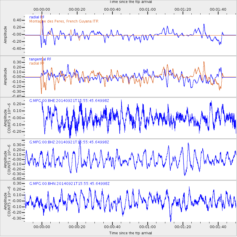
MPG Montagne des Peres, French Guyana - Earthquake Result Viewer
*The percent match for this event was below the threshold and hence no stack was calculated.
| Earthquake location: |
Easter Island Region |
| Earthquake latitude/longitude: |
-26.8/-114.3 |
| Earthquake time(UTC): |
2014/09/21 (264) 15:45:20 GMT |
| Earthquake Depth: |
10 km |
| Earthquake Magnitude: |
5.2 MW |
| Earthquake Catalog/Contributor: |
ISC/ISC |
|
| Network: |
G GEOSCOPE |
| Station: |
MPG Montagne des Peres, French Guyana |
| Lat/Lon: |
5.11 N/52.64 W |
| Elevation: |
147 m |
|
| Distance: |
67.5 deg |
| Az: |
71.609 deg |
| Baz: |
238.356 deg |
| Ray Param: |
$rayparam |
*The percent match for this event was below the threshold and hence was not used in the summary stack. |
|
| Radial Match: |
64.83003 % |
| Radial Bump: |
400 |
| Transverse Match: |
51.965393 % |
| Transverse Bump: |
400 |
| SOD ConfigId: |
3390531 |
| Insert Time: |
2019-04-14 03:47:25.472 +0000 |
| GWidth: |
2.5 |
| Max Bumps: |
400 |
| Tol: |
0.001 |
|
Signal To Noise
| Channel | StoN | STA | LTA |
| G:MPG:00:BHZ:20140921T15:55:45.64998Z | 1.0202101 | 1.1262038E-7 | 1.10389394E-7 |
| G:MPG:00:BHN:20140921T15:55:45.64998Z | 0.992801 | 1.2791617E-7 | 1.2884371E-7 |
| G:MPG:00:BHE:20140921T15:55:45.64998Z | 0.4871025 | 5.6621847E-8 | 1.16242155E-7 |
| Arrivals |
| Ps | |
| PpPs | |
| PsPs/PpSs | |


