You are here: Home > Network List > TA - USArray Transportable Network (new EarthScope stations) Stations List
> Station T60A Surry, VA, USA > Earthquake Result Viewer
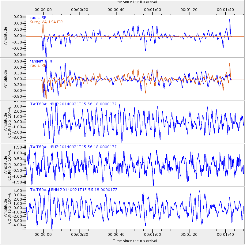
T60A Surry, VA, USA - Earthquake Result Viewer
*The percent match for this event was below the threshold and hence no stack was calculated.
| Earthquake location: |
Easter Island Region |
| Earthquake latitude/longitude: |
-26.8/-114.3 |
| Earthquake time(UTC): |
2014/09/21 (264) 15:45:20 GMT |
| Earthquake Depth: |
10 km |
| Earthquake Magnitude: |
5.2 MW |
| Earthquake Catalog/Contributor: |
ISC/ISC |
|
| Network: |
TA USArray Transportable Network (new EarthScope stations) |
| Station: |
T60A Surry, VA, USA |
| Lat/Lon: |
37.14 N/76.73 W |
| Elevation: |
11 m |
|
| Distance: |
72.8 deg |
| Az: |
30.658 deg |
| Baz: |
214.766 deg |
| Ray Param: |
$rayparam |
*The percent match for this event was below the threshold and hence was not used in the summary stack. |
|
| Radial Match: |
58.664818 % |
| Radial Bump: |
400 |
| Transverse Match: |
67.72789 % |
| Transverse Bump: |
400 |
| SOD ConfigId: |
3390531 |
| Insert Time: |
2019-04-14 03:50:38.295 +0000 |
| GWidth: |
2.5 |
| Max Bumps: |
400 |
| Tol: |
0.001 |
|
Signal To Noise
| Channel | StoN | STA | LTA |
| TA:T60A: :BHZ:20140921T15:56:18.000017Z | 1.1676388 | 6.6661596E-7 | 5.7090944E-7 |
| TA:T60A: :BHN:20140921T15:56:18.000017Z | 2.799712 | 2.7856638E-6 | 9.949823E-7 |
| TA:T60A: :BHE:20140921T15:56:18.000017Z | 1.1602272 | 1.822304E-6 | 1.570644E-6 |
| Arrivals |
| Ps | |
| PpPs | |
| PsPs/PpSs | |


