You are here: Home > Network List > IU - Global Seismograph Network (GSN - IRIS/USGS) Stations List
> Station POHA Pohakuloa, Hawaii, USA > Earthquake Result Viewer
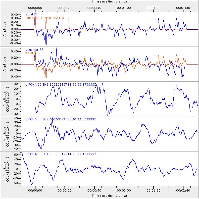
POHA Pohakuloa, Hawaii, USA - Earthquake Result Viewer
*The percent match for this event was below the threshold and hence no stack was calculated.
| Earthquake location: |
South Of Fiji Islands |
| Earthquake latitude/longitude: |
-23.9/178.4 |
| Earthquake time(UTC): |
2002/08/19 (231) 11:23:06 GMT |
| Earthquake Depth: |
677 km |
| Earthquake Magnitude: |
6.1 MB |
| Earthquake Catalog/Contributor: |
WHDF/NEIC |
|
| Network: |
IU Global Seismograph Network (GSN - IRIS/USGS) |
| Station: |
POHA Pohakuloa, Hawaii, USA |
| Lat/Lon: |
19.76 N/155.53 W |
| Elevation: |
1967 m |
|
| Distance: |
50.3 deg |
| Az: |
32.577 deg |
| Baz: |
211.549 deg |
| Ray Param: |
$rayparam |
*The percent match for this event was below the threshold and hence was not used in the summary stack. |
|
| Radial Match: |
63.04682 % |
| Radial Bump: |
400 |
| Transverse Match: |
57.15157 % |
| Transverse Bump: |
400 |
| SOD ConfigId: |
590571 |
| Insert Time: |
2013-09-24 23:42:26.689 +0000 |
| GWidth: |
2.5 |
| Max Bumps: |
400 |
| Tol: |
0.001 |
|
Signal To Noise
| Channel | StoN | STA | LTA |
| IU:POHA:00:BHZ:20020819T11:30:33.173999Z | 1.754183 | 2.3543382E-5 | 1.34212805E-5 |
| IU:POHA:00:BH1:20020819T11:30:33.173999Z | 0.5500911 | 1.4788744E-5 | 2.6884172E-5 |
| IU:POHA:00:BH2:20020819T11:30:33.173999Z | 0.8628673 | 1.1479151E-5 | 1.33034955E-5 |
| Arrivals |
| Ps | |
| PpPs | |
| PsPs/PpSs | |


