You are here: Home > Network List > KN - Kyrgyz Seismic Telemetry Network Stations List
> Station CHM KN.CHM > Earthquake Result Viewer
CHM KN.CHM - Earthquake Result Viewer
*The percent match for this event was below the threshold and hence no stack was calculated.
| Earthquake location: |
Bonin Islands, Japan Region |
| Earthquake latitude/longitude: |
27.9/139.6 |
| Earthquake time(UTC): |
2014/09/21 (264) 17:32:05 GMT |
| Earthquake Depth: |
491 km |
| Earthquake Magnitude: |
5.5 MWW |
| Earthquake Catalog/Contributor: |
NEIC PDE/NEIC COMCAT |
|
| Network: |
KN Kyrgyz Seismic Telemetry Network |
| Station: |
CHM KN.CHM |
| Lat/Lon: |
43.00 N/74.75 E |
| Elevation: |
655 m |
|
| Distance: |
53.7 deg |
| Az: |
304.468 deg |
| Baz: |
83.842 deg |
| Ray Param: |
$rayparam |
*The percent match for this event was below the threshold and hence was not used in the summary stack. |
|
| Radial Match: |
31.382992 % |
| Radial Bump: |
400 |
| Transverse Match: |
25.398567 % |
| Transverse Bump: |
400 |
| SOD ConfigId: |
3390531 |
| Insert Time: |
2019-04-14 03:55:56.874 +0000 |
| GWidth: |
2.5 |
| Max Bumps: |
400 |
| Tol: |
0.001 |
|
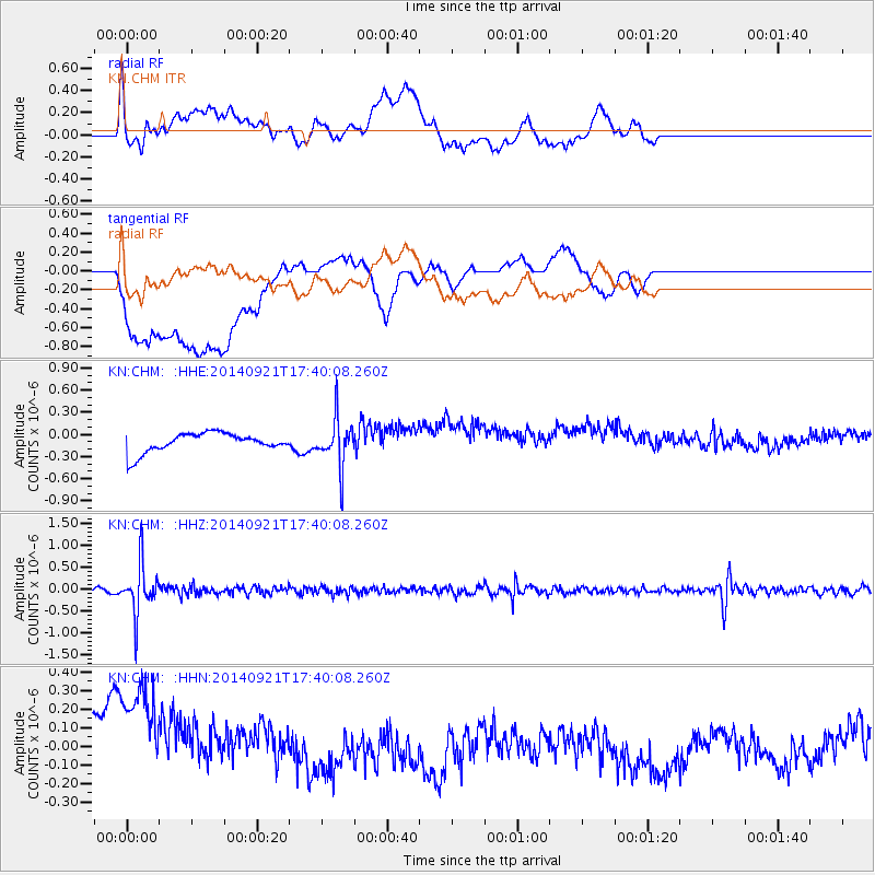
Signal To Noise
| Channel | StoN | STA | LTA |
| KN:CHM: :HHZ:20140921T17:40:08.260Z | 12.232494 | 5.758237E-7 | 4.7073286E-8 |
| KN:CHM: :HHN:20140921T17:40:08.260Z | 1.4674677 | 4.977564E-7 | 3.391941E-7 |
| KN:CHM: :HHE:20140921T17:40:08.260Z | 2.8929603 | 3.2987626E-7 | 1.1402724E-7 |
| Arrivals |
| Ps | |
| PpPs | |
| PsPs/PpSs | |


