You are here: Home > Network List > IU - Global Seismograph Network (GSN - IRIS/USGS) Stations List
> Station RSSD Black Hills, South Dakota, USA > Earthquake Result Viewer
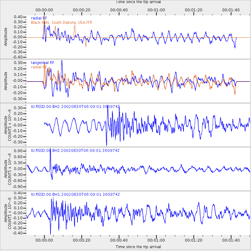
RSSD Black Hills, South Dakota, USA - Earthquake Result Viewer
*The percent match for this event was below the threshold and hence no stack was calculated.
| Earthquake location: |
Kuril Islands |
| Earthquake latitude/longitude: |
44.5/149.1 |
| Earthquake time(UTC): |
2002/08/30 (242) 05:58:21 GMT |
| Earthquake Depth: |
31 km |
| Earthquake Magnitude: |
5.7 MB, 5.5 MW, 5.3 MW |
| Earthquake Catalog/Contributor: |
WHDF/NEIC |
|
| Network: |
IU Global Seismograph Network (GSN - IRIS/USGS) |
| Station: |
RSSD Black Hills, South Dakota, USA |
| Lat/Lon: |
44.12 N/104.04 W |
| Elevation: |
2060 m |
|
| Distance: |
70.4 deg |
| Az: |
46.999 deg |
| Baz: |
313.371 deg |
| Ray Param: |
$rayparam |
*The percent match for this event was below the threshold and hence was not used in the summary stack. |
|
| Radial Match: |
52.53891 % |
| Radial Bump: |
400 |
| Transverse Match: |
70.58155 % |
| Transverse Bump: |
400 |
| SOD ConfigId: |
590571 |
| Insert Time: |
2013-09-24 23:47:27.286 +0000 |
| GWidth: |
2.5 |
| Max Bumps: |
400 |
| Tol: |
0.001 |
|
Signal To Noise
| Channel | StoN | STA | LTA |
| IU:RSSD:00:BHZ:20020830T06:09:01.360974Z | 3.5312214 | 2.9002922E-7 | 8.2132836E-8 |
| IU:RSSD:00:BH1:20020830T06:09:01.360974Z | 2.2589884 | 1.3551895E-7 | 5.999098E-8 |
| IU:RSSD:00:BH2:20020830T06:09:01.360974Z | 1.5731083 | 1.2567087E-7 | 7.988697E-8 |
| Arrivals |
| Ps | |
| PpPs | |
| PsPs/PpSs | |


