You are here: Home > Network List > IU - Global Seismograph Network (GSN - IRIS/USGS) Stations List
> Station POHA Pohakuloa, Hawaii, USA > Earthquake Result Viewer
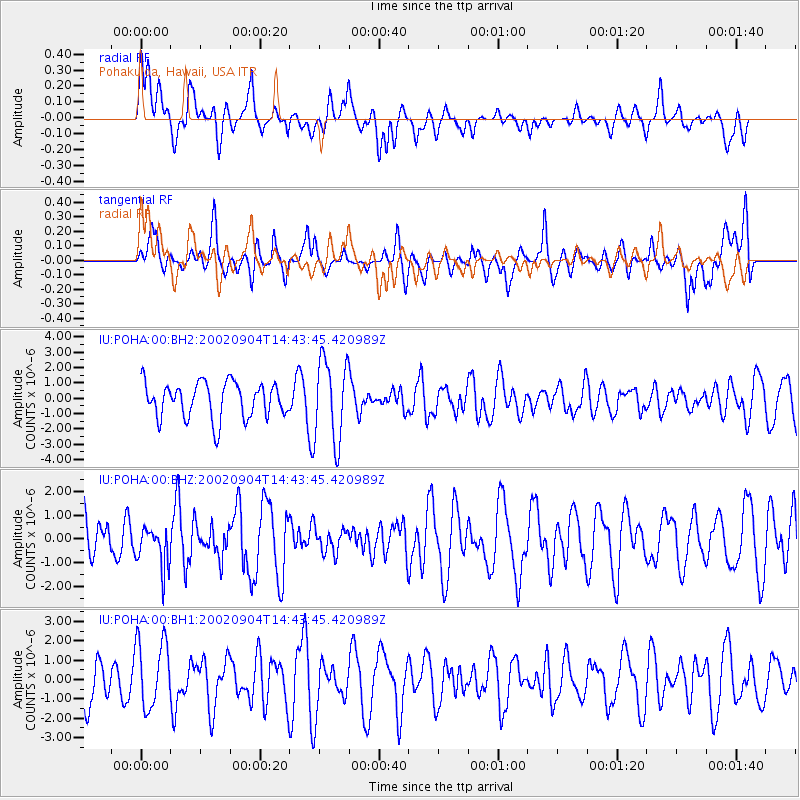
POHA Pohakuloa, Hawaii, USA - Earthquake Result Viewer
*The percent match for this event was below the threshold and hence no stack was calculated.
| Earthquake location: |
Admiralty Islands Region, P.N.G. |
| Earthquake latitude/longitude: |
-0.8/147.8 |
| Earthquake time(UTC): |
2002/09/04 (247) 14:34:15 GMT |
| Earthquake Depth: |
10 km |
| Earthquake Magnitude: |
5.8 MB, 5.1 MS, 5.6 MW, 5.5 MW |
| Earthquake Catalog/Contributor: |
WHDF/NEIC |
|
| Network: |
IU Global Seismograph Network (GSN - IRIS/USGS) |
| Station: |
POHA Pohakuloa, Hawaii, USA |
| Lat/Lon: |
19.76 N/155.53 W |
| Elevation: |
1967 m |
|
| Distance: |
59.2 deg |
| Az: |
66.434 deg |
| Baz: |
256.679 deg |
| Ray Param: |
$rayparam |
*The percent match for this event was below the threshold and hence was not used in the summary stack. |
|
| Radial Match: |
40.150196 % |
| Radial Bump: |
400 |
| Transverse Match: |
58.68573 % |
| Transverse Bump: |
400 |
| SOD ConfigId: |
590571 |
| Insert Time: |
2013-09-24 23:50:05.709 +0000 |
| GWidth: |
2.5 |
| Max Bumps: |
400 |
| Tol: |
0.001 |
|
Signal To Noise
| Channel | StoN | STA | LTA |
| IU:POHA:00:BHZ:20020904T14:43:45.420989Z | 0.72319114 | 8.5992156E-7 | 1.1890654E-6 |
| IU:POHA:00:BH1:20020904T14:43:45.420989Z | 1.6078823 | 1.744604E-6 | 1.0850322E-6 |
| IU:POHA:00:BH2:20020904T14:43:45.420989Z | 2.3346066 | 2.7017745E-6 | 1.1572719E-6 |
| Arrivals |
| Ps | |
| PpPs | |
| PsPs/PpSs | |


