You are here: Home > Network List > IU - Global Seismograph Network (GSN - IRIS/USGS) Stations List
> Station RSSD Black Hills, South Dakota, USA > Earthquake Result Viewer
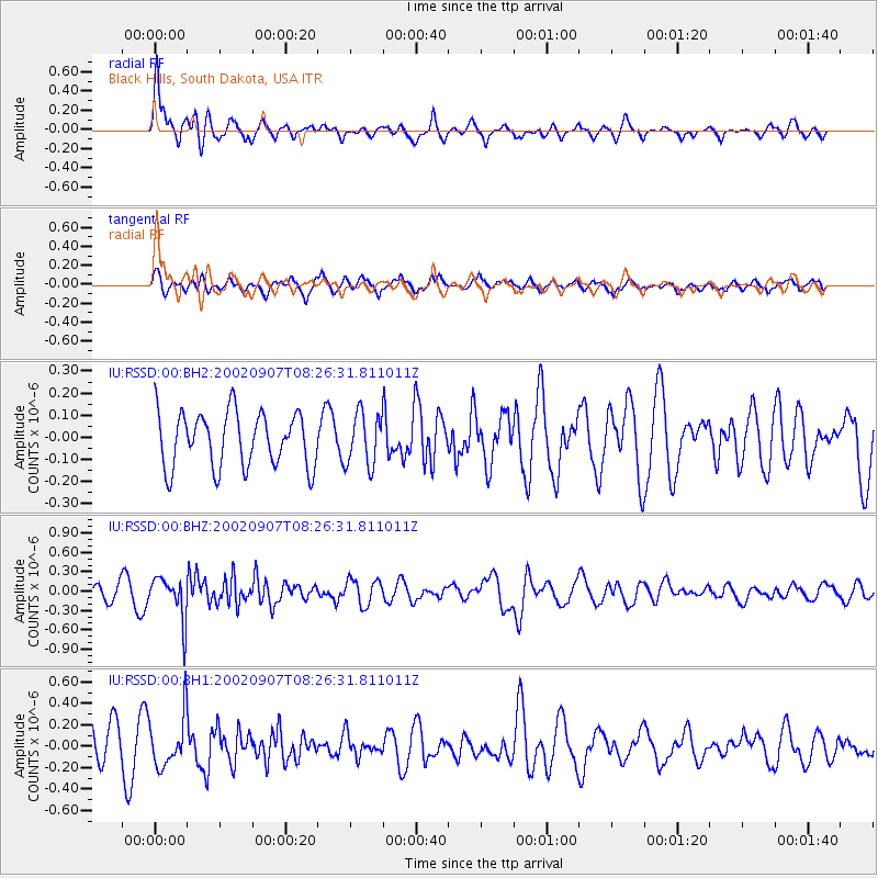
RSSD Black Hills, South Dakota, USA - Earthquake Result Viewer
*The percent match for this event was below the threshold and hence no stack was calculated.
| Earthquake location: |
Fiji Islands Region |
| Earthquake latitude/longitude: |
-20.3/-176.0 |
| Earthquake time(UTC): |
2002/09/07 (250) 08:14:19 GMT |
| Earthquake Depth: |
210 km |
| Earthquake Magnitude: |
5.5 MB, 6.0 MW, 6.0 MW |
| Earthquake Catalog/Contributor: |
WHDF/NEIC |
|
| Network: |
IU Global Seismograph Network (GSN - IRIS/USGS) |
| Station: |
RSSD Black Hills, South Dakota, USA |
| Lat/Lon: |
44.12 N/104.04 W |
| Elevation: |
2060 m |
|
| Distance: |
91.7 deg |
| Az: |
43.257 deg |
| Baz: |
243.284 deg |
| Ray Param: |
$rayparam |
*The percent match for this event was below the threshold and hence was not used in the summary stack. |
|
| Radial Match: |
59.797985 % |
| Radial Bump: |
400 |
| Transverse Match: |
57.143288 % |
| Transverse Bump: |
400 |
| SOD ConfigId: |
590571 |
| Insert Time: |
2013-09-24 23:51:19.294 +0000 |
| GWidth: |
2.5 |
| Max Bumps: |
400 |
| Tol: |
0.001 |
|
Signal To Noise
| Channel | StoN | STA | LTA |
| IU:RSSD:00:BHZ:20020907T08:26:31.811011Z | 2.7088802 | 3.3069915E-7 | 1.2207965E-7 |
| IU:RSSD:00:BH1:20020907T08:26:31.811011Z | 1.1679695 | 2.368014E-7 | 2.0274622E-7 |
| IU:RSSD:00:BH2:20020907T08:26:31.811011Z | 0.9577685 | 1.1798096E-7 | 1.2318317E-7 |
| Arrivals |
| Ps | |
| PpPs | |
| PsPs/PpSs | |


